Rückersdorf geodata
Rückersdorf (Thuringia) is a populated place; located in Germany in Europe/Berlin (GMT+2) time zone. With population of 840 people, there are 7742 cities with bigger population in this country. Compared to other cities in Germany, 53.1% of cities are located further ↓South; 74% of cities are located further ←West and 55% of cities have higher elevation than Rückersdorf. Note1
Administrative division(s):
- Level 1: Thuringia
- Level 3: Saalfeld-Rudolstadt
- Level 4: Uhlstädt-Kirchhasel


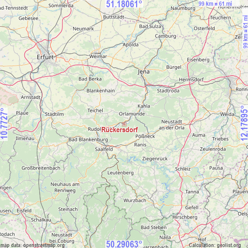
Rückersdorf GPS coordinates[2]
50° 44' 15.828" North, 11° 28' 32.952" East
| Map corner | latitude | longitude |
|---|---|---|
| Upper-left | 51.18061°, | 10.7727° |
| Center: | 50.73773°, | 11.47582° |
| Lower-right: | 50.29063°, | 12.17895° |
| Map W x H: | 99×99 km | = 61.5×61.5mi |
| max Lat: | 55.01917° ⇑46.9% North |
| Rückersdorf: | 50.73773° |
| min Lat: | ⇓53.1% South 47.40724° |
| min Long | Rückersdorf | max Long |
| 5.92978° | 11.47582° | 14.98853° |
| W 74%⇐ | ⇒26% E |
Elevation
Elevation of Rückersdorf is 188 m = 617 ft, and this is 61.1 m = 200 ft below average elevation for this country.
| Max E: |
1256 m = 4121 ft | 55% |
| Avg. | 249.1 m = 817 ft | |
| Rückersdorf | 188 m = 617 ft | |
Min E: |
-5 m = -16 ft | 45% |
See also: Germany elevation on elevation.city.
Geographical zone
Rückersdorf is located in North temperate zone (between Tropic of Cancer and the Arctic Circle). Distance of this North polar circle is 1759.7 km =1093.4 mi to North.| Distance of | km | miles | from Rückersdorf |
|---|---|---|---|
| North Pole | 4365.6 | 2712.7 | to North |
| Arctic Circle | 1759.7 | 1093.4 | to North |
| Tropic Cancer | 3035.6 | 1886.2 | to South |
| Equator | 5641.5 | 3505.5 | to South |


Nearby cities:
15 places around Rückersdorf: (largest is in red/bold)
• Bibra
8.9 km =5.5 mi,  34°
34°
• Birkigt
7.6 km =4.7 mi,  175°
175°
• Eichenberg
8 km =5 mi, 30°
• Freienorla
6.1 km =3.8 mi,  58°
58°
• Großeutersdorf
8.2 km =5.1 mi,  51°
51°
• Großkochberg
9.4 km =5.8 mi,  296°
296°
• Gumperda
8.7 km =5.4 mi,  22°
22°
• Herschdorf
5.2 km =3.2 mi,  123°
123°
• Kleineutersdorf
9.1 km =5.7 mi, 56°
• Krölpa
8 km =5 mi,  146°
146°
• Langenorla
7.4 km =4.6 mi,  87°
87°
• Naundorf
5.6 km =3.5 mi,  235°
235°
• Orlamünde
5.1 km =3.2 mi,  36°
36°
• Reichenbach
6.5 km =4 mi,  205°
205°
• Reinstädt
8 km =5 mi,  359°
359°
Sources, notices
• [Note1] Compared only with cities in Germany existing in our database
• [Src1] Map data: © OpenStreetMap contributors (CC-BY-SA)
• [Src2] Other city data from geonames.org with taken over terms of usage.
• [Src3] Geographical zone / Annual Mean Temperature by Robert A. Rohde @ Wikipedia
