Naundorf geodata
Naundorf (Thuringia) is a populated place; located in Germany in Europe/Berlin (GMT+2) time zone. With population of 542 people, there are 9130 cities with bigger population in this country. Compared to other cities in Germany, 52.3% of cities are located further ↓South; 72.8% of cities are located further ←West and 51.3% of cities have higher elevation than Naundorf. Note1
Administrative division(s):
- Level 1: Thuringia
- Level 3: Saalfeld-Rudolstadt
- Level 4: Uhlstädt-Kirchhasel


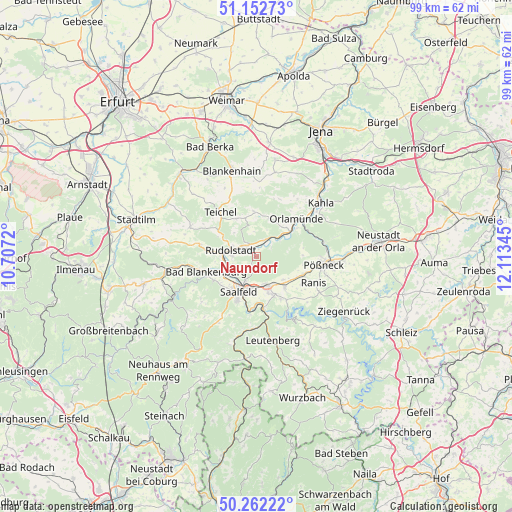
Naundorf GPS coordinates[2]
50° 42' 34.524" North, 11° 24' 37.152" East
| Map corner | latitude | longitude |
|---|---|---|
| Upper-left | 51.15273°, | 10.7072° |
| Center: | 50.70959°, | 11.41032° |
| Lower-right: | 50.26222°, | 12.11345° |
| Map W x H: | 99×99 km | = 61.5×61.5mi |
| max Lat: | 55.01917° ⇑47.7% North |
| Naundorf: | 50.70959° |
| min Lat: | ⇓52.3% South 47.40724° |
| min Long | Naundorf | max Long |
| 5.92978° | 11.41032° | 14.98853° |
| W 72.8%⇐ | ⇒27.2% E |
Elevation
Elevation of Naundorf is 216 m = 709 ft, and this is 33.1 m = 109 ft below average elevation for this country.
| Max E: |
1256 m = 4121 ft | 51.3% |
| Avg. | 249.1 m = 817 ft | |
| Naundorf | 216 m = 709 ft | |
Min E: |
-5 m = -16 ft | 48.7% |
See also: Germany elevation on elevation.city.
Geographical zone
Naundorf is located in North temperate zone (between Tropic of Cancer and the Arctic Circle). Distance of this North polar circle is 1762.8 km =1095.4 mi to North.| Distance of | km | miles | from Naundorf |
|---|---|---|---|
| North Pole | 4368.7 | 2714.6 | to North |
| Arctic Circle | 1762.8 | 1095.4 | to North |
| Tropic Cancer | 3032.5 | 1884.3 | to South |
| Equator | 5638.4 | 3503.5 | to South |


Nearby cities:
15 places around Naundorf: (largest is in red/bold)
• Bad Blankenburg
10.1 km =6.3 mi,  252°
252°
• Birkigt
6.9 km =4.3 mi,  130°
130°
• Goßwitz
9.5 km =5.9 mi,  150°
150°
• Großkochberg
8.2 km =5.1 mi,  332°
332°
• Herschdorf
8.9 km =5.5 mi,  88°
88°
• Kamsdorf
8 km =5 mi,  157°
157°
• Kaulsdorf
10.5 km =6.5 mi,  171°
171°
• Krölpa
9.7 km =6 mi,  111°
111°
• Könitz
8.6 km =5.3 mi,  140°
140°
• Orlamünde
10.6 km =6.6 mi,  46°
46°
• Reichenbach
3.3 km =2.1 mi, 146°
• Rudolstadt
5.1 km =3.2 mi,  283°
283°
• Rückersdorf
5.6 km =3.5 mi,  55°
55°
• Saalfeld
7.5 km =4.7 mi,  204°
204°
• Unterwellenborn
6.8 km =4.2 mi, 166°
Sources, notices
• [Note1] Compared only with cities in Germany existing in our database
• [Src1] Map data: © OpenStreetMap contributors (CC-BY-SA)
• [Src2] Other city data from geonames.org with taken over terms of usage.
• [Src3] Geographical zone / Annual Mean Temperature by Robert A. Rohde @ Wikipedia
