Röttingen geodata
Röttingen (Bavaria) is a populated place; located in Germany in Europe/Berlin (GMT+2) time zone. With population of 1,679 people, there are 5555 cities with bigger population in this country. Compared to other cities in Germany, 75.6% of cities are located further ↑North; 50.5% of cities are located further →East and 52.3% of cities have lower elevation than Röttingen. Note1
Administrative division(s):
- Level 1: Bavaria
- Level 2: Regierungsbezirk Unterfranken
- Level 3: Landkreis Würzburg
- Level 4: Röttingen


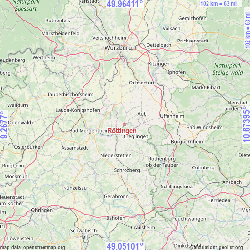
Röttingen GPS coordinates[2]
49° 30' 34.884" North, 9° 58' 14.952" East
| Map corner | latitude | longitude |
|---|---|---|
| Upper-left | 49.96411°, | 9.2677° |
| Center: | 49.50969°, | 9.97082° |
| Lower-right: | 49.05101°, | 10.67395° |
| Map W x H: | 101.5×101.5 km | = 63.1×63.1mi |
| max Lat: | 55.01917° ⇑75.6% North |
| Röttingen: | 49.50969° |
| min Lat: | ⇓24.4% South 47.40724° |
| min Long | Röttingen | max Long |
| 5.92978° | 9.97082° | 14.98853° |
| W 49.5%⇐ | ⇒50.5% E |
Elevation
Elevation of Röttingen is 242 m = 794 ft, and this is 7.1 m = 23 ft below average elevation for this country.
| Max E: |
1256 m = 4121 ft | 47.7% |
| Avg. | 249.1 m = 817 ft | |
| Röttingen | 242 m = 794 ft | |
Min E: |
-5 m = -16 ft | 52.3% |
See also: Germany elevation on elevation.city.
Geographical zone
Röttingen is located in North temperate zone (between Tropic of Cancer and the Arctic Circle). Distance of this North polar circle is 1896.2 km =1178.2 mi to North.| Distance of | km | miles | from Röttingen |
|---|---|---|---|
| North Pole | 4502.1 | 2797.5 | to North |
| Arctic Circle | 1896.2 | 1178.2 | to North |
| Tropic Cancer | 2899 | 1801.4 | to South |
| Equator | 5505 | 3420.6 | to South |


Nearby cities:
15 places around Röttingen: (largest is in red/bold)
• Aub
8.3 km =5.2 mi,  54°
54°
• Bad Mergentheim
14.4 km =8.9 mi,  262°
262°
• Bieberehren
2.9 km =1.8 mi,  72°
72°
• Bütthard
11.9 km =7.4 mi,  326°
326°
• Creglingen
6.3 km =3.9 mi,  135°
135°
• Gaukönigshofen
13.9 km =8.6 mi,  8°
8°
• Gelchsheim
7.8 km =4.8 mi,  27°
27°
• Hemmersheim
10.8 km =6.7 mi,  56°
56°
• Igersheim
11.2 km =7 mi, 261°
• Niederstetten
12.7 km =7.9 mi,  196°
196°
• Riedenheim
5.3 km =3.3 mi, 5°
• Simmershofen
12 km =7.5 mi,  77°
77°
• Sonderhofen
9.6 km =6 mi, 13°
• Tauberrettersheim
3 km =1.9 mi,  235°
235°
• Weikersheim
6.2 km =3.9 mi, 236°
Sources, notices
• [Note1] Compared only with cities in Germany existing in our database
• [Src1] Map data: © OpenStreetMap contributors (CC-BY-SA)
• [Src2] Other city data from geonames.org with taken over terms of usage.
• [Src3] Geographical zone / Annual Mean Temperature by Robert A. Rohde @ Wikipedia
