Wernshausen geodata
Wernshausen (Thuringia) is a populated place; located in Germany in Europe/Berlin (GMT+1) time zone. With population of 3,143 people, there are 3877 cities with bigger population in this country. Compared to other cities in Germany, 52.8% of cities are located further ↓South; 56.4% of cities are located further ←West and 55.7% of cities have lower elevation than Wernshausen. Note1
Administrative division(s):
- Level 1: Thuringia
- Level 3: Landkreis Schmalkalden-Meiningen
- Level 4: Schmalkalden, Kurort


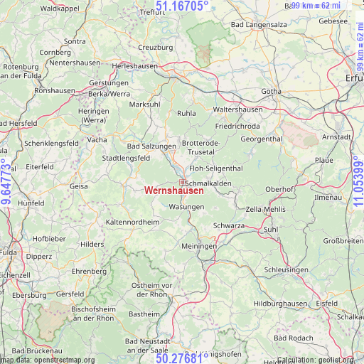
Wernshausen GPS coordinates[2]
50° 43' 26.544" North, 10° 21' 3.096" East
| Map corner | latitude | longitude |
|---|---|---|
| Upper-left | 51.16705°, | 9.64773° |
| Center: | 50.72404°, | 10.35086° |
| Lower-right: | 50.27681°, | 11.05399° |
| Map W x H: | 99×99 km | = 61.5×61.5mi |
| max Lat: | 55.01917° ⇑47.2% North |
| Wernshausen: | 50.72404° |
| min Lat: | ⇓52.8% South 47.40724° |
| min Long | Wernshausen | max Long |
| 5.92978° | 10.35086° | 14.98853° |
| W 56.4%⇐ | ⇒43.6% E |
Elevation
Elevation of Wernshausen is 263 m = 863 ft, and this is 13.9 m = 46 ft above average elevation for this country.
| Max E: |
1256 m = 4121 ft | 44.3% |
| Wernshausen | 263 m 863 ft | |
| Avg. | 249.1 m = 817 ft | |
Min E: |
-5 m = -16 ft | 55.7% |
See also: Germany elevation on elevation.city.
Geographical zone
Wernshausen is located in North temperate zone (between Tropic of Cancer and the Arctic Circle). Distance of this North polar circle is 1761.2 km =1094.4 mi to North.| Distance of | km | miles | from Wernshausen |
|---|---|---|---|
| North Pole | 4367.1 | 2713.6 | to North |
| Arctic Circle | 1761.2 | 1094.4 | to North |
| Tropic Cancer | 3034.1 | 1885.3 | to South |
| Equator | 5640 | 3504.5 | to South |


Nearby cities:
15 places around Wernshausen: (largest is in red/bold)
• Bad Liebenstein
10.2 km =6.3 mi,  0°
0°
• Barchfeld
9.2 km =5.7 mi,  337°
337°
• Breitenbach
10.6 km =6.6 mi,  111°
111°
• Breitungen
4.7 km =2.9 mi, 339°
• Fambach
1.5 km =0.9 mi,  47°
47°
• Hümpfershausen
10.5 km =6.5 mi,  232°
232°
• Immelborn
9.2 km =5.7 mi,  326°
326°
• Mehmels
10.2 km =6.3 mi,  186°
186°
• Metzels
10.4 km =6.5 mi,  145°
145°
• Rosa
7.2 km =4.5 mi,  259°
259°
• Roßdorf
9.8 km =6.1 mi,  254°
254°
• Schmalkalden
6.6 km =4.1 mi,  92°
92°
• Schwallungen
3.5 km =2.2 mi,  172°
172°
• Trusetal
8.1 km =5 mi,  35°
35°
• Wasungen
7 km =4.3 mi, 169°
Sources, notices
• [Note1] Compared only with cities in Germany existing in our database
• [Src1] Map data: © OpenStreetMap contributors (CC-BY-SA)
• [Src2] Other city data from geonames.org with taken over terms of usage.
• [Src3] Geographical zone / Annual Mean Temperature by Robert A. Rohde @ Wikipedia
