Rheda-Wiedenbrück geodata
Rheda-Wiedenbrück (North Rhine-Westphalia) is a populated place; located in Germany in Europe/Berlin (GMT+2) time zone. With population of 46,123 people, there are 254 cities with bigger population in this country. Compared to other cities in Germany, 70.5% of cities are located further ↓South; 72.9% of cities are located further →East and 73% of cities have higher elevation than Rheda-Wiedenbrück. Note1
Administrative division(s):
- Level 1: North Rhine-Westphalia
- Level 2: Regierungsbezirk Detmold
- Level 3: Kreis Gütersloh
- Level 4: Rheda-Wiedenbrück


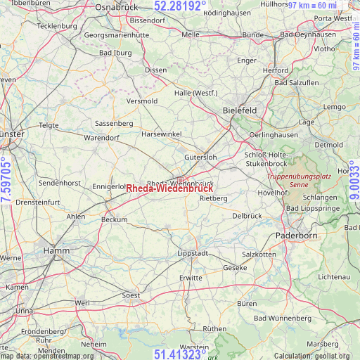
Rheda-Wiedenbrück GPS coordinates[2]
51° 50' 58.812" North, 8° 18' 0.612" East
| Map corner | latitude | longitude |
|---|---|---|
| Upper-left | 52.28192°, | 7.59705° |
| Center: | 51.84967°, | 8.30017° |
| Lower-right: | 51.41323°, | 9.0033° |
| Map W x H: | 96.6×96.6 km | = 60×60mi |
| max Lat: | 55.01917° ⇑29.5% North |
| Rheda-Wiedenbrück: | 51.84967° |
| min Lat: | ⇓70.5% South 47.40724° |
| min Long | Rheda-Wiedenbr� | max Long |
| 5.92978° | 8.30017° | 14.98853° |
| W 27.1%⇐ | ⇒72.9% E |
Elevation
Elevation of Rheda-Wiedenbrück is 72 m = 236 ft, and this is 177.1 m = 581 ft below average elevation for this country.
| Max E: |
1256 m = 4121 ft | 73% |
| Avg. | 249.1 m = 817 ft | |
| Rheda-Wiedenbrück | 72 m = 236 ft | |
Min E: |
-5 m = -16 ft | 27% |
See also: Rheda-Wiedenbrück elevation on elevation.city.
Geographical zone
Rheda-Wiedenbrück is located in North temperate zone (between Tropic of Cancer and the Arctic Circle). Distance of this North polar circle is 1636 km =1016.6 mi to North.| Distance of | km | miles | from Rheda-Wiedenbrück |
|---|---|---|---|
| North Pole | 4241.9 | 2635.8 | to North |
| Arctic Circle | 1636 | 1016.6 | to North |
| Tropic Cancer | 3159.2 | 1963 | to South |
| Equator | 5765.1 | 3582.3 | to South |


Nearby cities:
15 places around Rheda-Wiedenbrück: (largest is in red/bold)
• Beckum
20.7 km =12.9 mi,  239°
239°
• Beelen
15.7 km =9.8 mi,  304°
304°
• Delbrück
20.3 km =12.6 mi,  117°
117°
• Ennigerloh
18.5 km =11.5 mi,  266°
266°
• Gütersloh
8.3 km =5.2 mi,  40°
40°
• Halle
23.8 km =14.8 mi,  10°
10°
• Harsewinkel
13.5 km =8.4 mi,  338°
338°
• Langenberg
8.7 km =5.4 mi,  171°
171°
• Lippstadt
19.8 km =12.3 mi, 171°
• Oelde
10.8 km =6.7 mi,  257°
257°
• Rietberg
9.9 km =6.2 mi, 117°
• Steinhagen
18.1 km =11.2 mi,  22°
22°
• Verl
15.3 km =9.5 mi,  75°
75°
• Versmold
23.5 km =14.6 mi,  334°
334°
• Wadersloh
13.4 km =8.3 mi,  194°
194°
Sources, notices
• [Note1] Compared only with cities in Germany existing in our database
• [Src1] Map data: © OpenStreetMap contributors (CC-BY-SA)
• [Src2] Other city data from geonames.org with taken over terms of usage.
• [Src3] Geographical zone / Annual Mean Temperature by Robert A. Rohde @ Wikipedia
