Rehren geodata
Rehren (Lower Saxony) is a seat of a fourth-order administrative division; located in Germany in Europe/Berlin (GMT+2) time zone. In our database, there are 11009 cities with bigger population. Compared to other cities in Germany, 74.4% of cities are located further ↓South; 61.8% of cities are located further →East and 59.8% of cities have higher elevation than Rehren. Note1


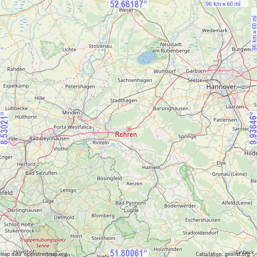
Rehren GPS coordinates[2]
52° 13' 59.988" North, 9° 13' 59.988" East
| Map corner | latitude | longitude |
|---|---|---|
| Upper-left | 52.66187°, | 8.53021° |
| Center: | 52.23333°, | 9.23333° |
| Lower-right: | 51.80061°, | 9.93646° |
| Map W x H: | 95.8×95.8 km | = 59.5×59.5mi |
| max Lat: | 55.01917° ⇑25.6% North |
| Rehren: | 52.23333° |
| min Lat: | ⇓74.4% South 47.40724° |
| min Long | Rehren | max Long |
| 5.92978° | 9.23333° | 14.98853° |
| W 38.2%⇐ | ⇒61.8% E |
Elevation
Elevation of Rehren is 154 m = 505 ft, and this is 95.1 m = 312 ft below average elevation for this country.
| Max E: |
1256 m = 4121 ft | 59.8% |
| Avg. | 249.1 m = 817 ft | |
| Rehren | 154 m = 505 ft | |
Min E: |
-5 m = -16 ft | 40.2% |
See also: Germany elevation on elevation.city.
Geographical zone
Rehren is located in North temperate zone (between Tropic of Cancer and the Arctic Circle). Distance of this North polar circle is 1593.4 km =990.1 mi to North.| Distance of | km | miles | from Rehren |
|---|---|---|---|
| North Pole | 4199.3 | 2609.3 | to North |
| Arctic Circle | 1593.4 | 990.1 | to North |
| Tropic Cancer | 3201.9 | 1989.6 | to South |
| Equator | 5807.8 | 3608.8 | to South |


Nearby cities:
15 places around Rehren: (largest is in red/bold)
• Ahnsen
9.3 km =5.8 mi,  284°
284°
• Apelern
9.4 km =5.8 mi,  48°
48°
• Bad Eilsen
9.3 km =5.8 mi, 276°
• Buchholz
7.2 km =4.5 mi,  264°
264°
• Heeßen
9.3 km =5.8 mi,  269°
269°
• Hessisch Oldendorf
6.8 km =4.2 mi,  170°
170°
• Heuerßen
11.1 km =6.9 mi,  15°
15°
• Hülsede
8.9 km =5.5 mi,  78°
78°
• Lauenau
10.3 km =6.4 mi,  63°
63°
• Luhden
9.6 km =6 mi, 264°
• Messenkamp
10.4 km =6.5 mi,  73°
73°
• Nienstädt
8.1 km =5 mi,  324°
324°
• Obernkirchen
8.3 km =5.2 mi,  301°
301°
• Pohle
8.4 km =5.2 mi, 64°
• Stadthagen
10.2 km =6.3 mi,  348°
348°
Sources, notices
• [Note1] Compared only with cities in Germany existing in our database
• [Src1] Map data: © OpenStreetMap contributors (CC-BY-SA)
• [Src2] Other city data from geonames.org with taken over terms of usage.
• [Src3] Geographical zone / Annual Mean Temperature by Robert A. Rohde @ Wikipedia
