Rehau geodata
Rehau (Bavaria) is a populated place; located in Germany in Europe/Berlin (GMT+2) time zone. With population of 10,058 people, there are 1629 cities with bigger population in this country. Compared to other cities in Germany, 58% of cities are located further ↑North; 82.3% of cities are located further ←West and 90.6% of cities have lower elevation than Rehau. Note1
Administrative division(s):
- Level 1: Bavaria
- Level 2: Upper Franconia
- Level 3: Landkreis Hof
- Level 4: Rehau


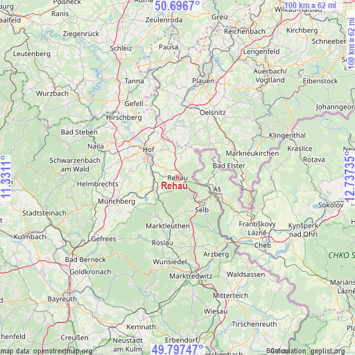
Rehau GPS coordinates[2]
50° 14' 57.156" North, 12° 2' 3.192" East
| Map corner | latitude | longitude |
|---|---|---|
| Upper-left | 50.6967°, | 11.3311° |
| Center: | 50.24921°, | 12.03422° |
| Lower-right: | 49.79747°, | 12.73735° |
| Map W x H: | 100×100 km | = 62.1×62.1mi |
| max Lat: | 55.01917° ⇑58% North |
| Rehau: | 50.24921° |
| min Lat: | ⇓42% South 47.40724° |
| min Long | Rehau | max Long |
| 5.92978° | 12.03422° | 14.98853° |
| W 82.3%⇐ | ⇒17.7% E |
Elevation
Elevation of Rehau is 521 m = 1709 ft, and this is 271.9 m = 892 ft above average elevation for this country.
| Max E: |
1256 m = 4121 ft | 9.4% |
| Rehau | 521 m 1709 ft | |
| Avg. | 249.1 m = 817 ft | |
Min E: |
-5 m = -16 ft | 90.6% |
See also: Germany elevation on elevation.city.
Geographical zone
Rehau is located in North temperate zone (between Tropic of Cancer and the Arctic Circle). Distance of this North polar circle is 1814 km =1127.2 mi to North.| Distance of | km | miles | from Rehau |
|---|---|---|---|
| North Pole | 4419.9 | 2746.4 | to North |
| Arctic Circle | 1814 | 1127.2 | to North |
| Tropic Cancer | 2981.3 | 1852.5 | to South |
| Equator | 5587.2 | 3471.7 | to South |


Nearby cities:
15 places around Rehau: (largest is in red/bold)
• Bad Elster
14.7 km =9.1 mi,  75°
75°
• Döhlau
7.1 km =4.4 mi,  302°
302°
• Eichigt
14.6 km =9.1 mi,  40°
40°
• Gattendorf
8.5 km =5.3 mi,  342°
342°
• Haag
6.8 km =4.2 mi,  26°
26°
• Hof
11.2 km =7 mi,  309°
309°
• Kirchenlamitz
12.4 km =7.7 mi,  209°
209°
• Konradsreuth
13.2 km =8.2 mi,  278°
278°
• Marktleuthen
13.4 km =8.3 mi,  189°
189°
• Oberkotzau
7.2 km =4.5 mi, 281°
• Regnitzlosau
5.8 km =3.6 mi,  11°
11°
• Schwarzenbach an der Saale
7.6 km =4.7 mi,  247°
247°
• Schönwald
6.6 km =4.1 mi,  146°
146°
• Selb
11.1 km =6.9 mi,  141°
141°
• Trogen
14.4 km =8.9 mi, 335°
Sources, notices
• [Note1] Compared only with cities in Germany existing in our database
• [Src1] Map data: © OpenStreetMap contributors (CC-BY-SA)
• [Src2] Other city data from geonames.org with taken over terms of usage.
• [Src3] Geographical zone / Annual Mean Temperature by Robert A. Rohde @ Wikipedia
