Trogen geodata
Trogen (Bavaria) is a seat of a fourth-order administrative division; located in Germany in Europe/Berlin (GMT+2) time zone. With population of 1,636 people, there are 5627 cities with bigger population in this country. Compared to other cities in Germany, 55.4% of cities are located further ↑North; 81.1% of cities are located further ←West and 91.1% of cities have lower elevation than Trogen. Note1
Administrative division(s):
- Level 1: Bavaria
- Level 2: Upper Franconia
- Level 3: Landkreis Hof
- Level 4: Trogen


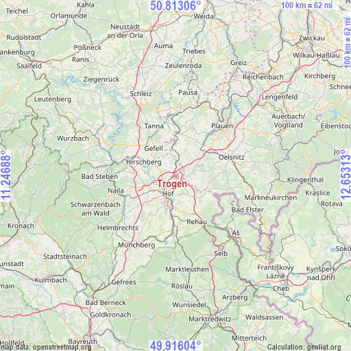
Trogen GPS coordinates[2]
50° 22' 0.012" North, 11° 57' 0" East
| Map corner | latitude | longitude |
|---|---|---|
| Upper-left | 50.81306°, | 11.24688° |
| Center: | 50.36667°, | 11.95° |
| Lower-right: | 49.91604°, | 12.65313° |
| Map W x H: | 99.7×99.7 km | = 62×62mi |
| max Lat: | 55.01917° ⇑55.4% North |
| Trogen: | 50.36667° |
| min Lat: | ⇓44.6% South 47.40724° |
| min Long | Trogen | max Long |
| 5.92978° | 11.95° | 14.98853° |
| W 81.1%⇐ | ⇒18.9% E |
Elevation
Elevation of Trogen is 528 m = 1732 ft, and this is 278.9 m = 915 ft above average elevation for this country.
| Max E: |
1256 m = 4121 ft | 8.9% |
| Trogen | 528 m 1732 ft | |
| Avg. | 249.1 m = 817 ft | |
Min E: |
-5 m = -16 ft | 91.1% |
See also: Germany elevation on elevation.city.
Geographical zone
Trogen is located in North temperate zone (between Tropic of Cancer and the Arctic Circle). Distance of this North polar circle is 1800.9 km =1119 mi to North.| Distance of | km | miles | from Trogen |
|---|---|---|---|
| North Pole | 4406.8 | 2738.3 | to North |
| Arctic Circle | 1800.9 | 1119 | to North |
| Tropic Cancer | 2994.3 | 1860.6 | to South |
| Equator | 5600.2 | 3479.8 | to South |


Nearby cities:
15 places around Trogen: (largest is in red/bold)
• Berg
12.2 km =7.6 mi,  274°
274°
• Bösenbrunn
11.2 km =7 mi,  72°
72°
• Döhlau
9.3 km =5.8 mi,  180°
180°
• Feilitzsch
1.2 km =0.7 mi, 270°
• Gattendorf
6 km =3.7 mi,  145°
145°
• Haag
11.4 km =7.1 mi,  127°
127°
• Hof
6.5 km =4 mi,  203°
203°
• Köditz
8 km =5 mi,  242°
242°
• Leupoldsgrün
13 km =8.1 mi, 235°
• Oberkotzau
11.6 km =7.2 mi,  185°
185°
• Regnitzlosau
10.3 km =6.4 mi,  136°
136°
• Reuth
11.5 km =7.1 mi,  3°
3°
• Triebel
12.2 km =7.6 mi,  87°
87°
• Töpen
6.1 km =3.8 mi,  296°
296°
• Weischlitz
12.4 km =7.7 mi,  41°
41°
Sources, notices
• [Note1] Compared only with cities in Germany existing in our database
• [Src1] Map data: © OpenStreetMap contributors (CC-BY-SA)
• [Src2] Other city data from geonames.org with taken over terms of usage.
• [Src3] Geographical zone / Annual Mean Temperature by Robert A. Rohde @ Wikipedia
