Flechtingen geodata
Flechtingen (Saxony-Anhalt) is a seat of a fourth-order administrative division; located in Germany in Europe/Berlin (GMT+2) time zone. With population of 1,766 people, there are 5403 cities with bigger population in this country. Compared to other cities in Germany, 75.5% of cities are located further ↓South; 70.5% of cities are located further ←West and 68.3% of cities have higher elevation than Flechtingen. Note1


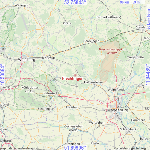
Flechtingen GPS coordinates[2]
52° 19' 50.988" North, 11° 14' 30.336" East
| Map corner | latitude | longitude |
|---|---|---|
| Upper-left | 52.75843°, | 10.53864° |
| Center: | 52.33083°, | 11.24176° |
| Lower-right: | 51.89906°, | 11.94489° |
| Map W x H: | 95.6×95.6 km | = 59.4×59.4mi |
| max Lat: | 55.01917° ⇑24.5% North |
| Flechtingen: | 52.33083° |
| min Lat: | ⇓75.5% South 47.40724° |
| min Long | Flechtingen | max Long |
| 5.92978° | 11.24176° | 14.98853° |
| W 70.5%⇐ | ⇒29.5% E |
Elevation
Elevation of Flechtingen is 101 m = 331 ft, and this is 148.1 m = 486 ft below average elevation for this country.
| Max E: |
1256 m = 4121 ft | 68.3% |
| Avg. | 249.1 m = 817 ft | |
| Flechtingen | 101 m = 331 ft | |
Min E: |
-5 m = -16 ft | 31.7% |
See also: Germany elevation on elevation.city.
Geographical zone
Flechtingen is located in North temperate zone (between Tropic of Cancer and the Arctic Circle). Distance of this North polar circle is 1582.5 km =983.3 mi to North.| Distance of | km | miles | from Flechtingen |
|---|---|---|---|
| North Pole | 4188.4 | 2602.6 | to North |
| Arctic Circle | 1582.5 | 983.3 | to North |
| Tropic Cancer | 3212.7 | 1996.3 | to South |
| Equator | 5818.6 | 3615.5 | to South |


Nearby cities:
15 places around Flechtingen: (largest is in red/bold)
• Altenhausen
7.7 km =4.8 mi,  173°
173°
• Behnsdorf
6.3 km =3.9 mi,  254°
254°
• Bregenstedt
8.6 km =5.3 mi,  188°
188°
• Bülstringen
7.5 km =4.7 mi,  102°
102°
• Calvörde
8 km =5 mi,  26°
26°
• Eimersleben
12.4 km =7.7 mi, 193°
• Erxleben
12.5 km =7.8 mi,  179°
179°
• Etingen
8.5 km =5.3 mi,  325°
325°
• Haldensleben I
12.3 km =7.6 mi,  112°
112°
• Hörsingen
8.2 km =5.1 mi,  226°
226°
• Ivenrode
6.5 km =4 mi, 186°
• Rätzlingen
11.7 km =7.3 mi,  312°
312°
• Siestedt
10.3 km =6.4 mi,  262°
262°
• Süplingen
7.4 km =4.6 mi,  130°
130°
• Weferlingen
12.7 km =7.9 mi, 260°
Sources, notices
• [Note1] Compared only with cities in Germany existing in our database
• [Src1] Map data: © OpenStreetMap contributors (CC-BY-SA)
• [Src2] Other city data from geonames.org with taken over terms of usage.
• [Src3] Geographical zone / Annual Mean Temperature by Robert A. Rohde @ Wikipedia
