Rastorf geodata
Rastorf (Schleswig-Holstein) is a seat of a fourth-order administrative division; located in Germany in Europe/Berlin (GMT+2) time zone. With population of 879 people, there are 7594 cities with bigger population in this country. Compared to other cities in Germany, 95.9% of cities are located further ↓South; 54.9% of cities are located further ←West and 87.7% of cities have higher elevation than Rastorf. Note1


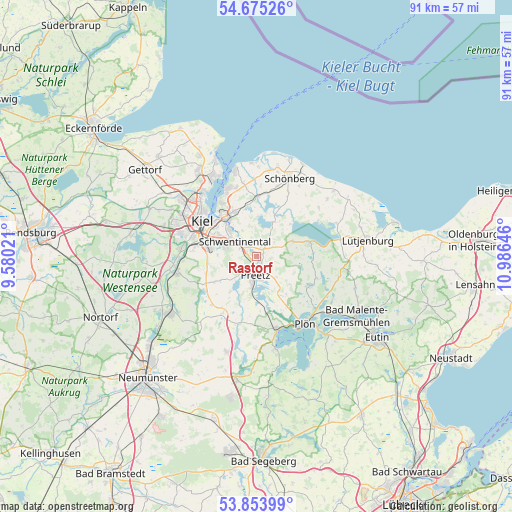
Rastorf GPS coordinates[2]
54° 16' 0.012" North, 10° 16' 59.988" East
| Map corner | latitude | longitude |
|---|---|---|
| Upper-left | 54.67526°, | 9.58021° |
| Center: | 54.26667°, | 10.28333° |
| Lower-right: | 53.85399°, | 10.98646° |
| Map W x H: | 91.3×91.3 km | = 56.7×56.7mi |
| max Lat: | 55.01917° ⇑4.1% North |
| Rastorf: | 54.26667° |
| min Lat: | ⇓95.9% South 47.40724° |
| min Long | Rastorf | max Long |
| 5.92978° | 10.28333° | 14.98853° |
| W 54.9%⇐ | ⇒45.1% E |
Elevation
Elevation of Rastorf is 28 m = 92 ft, and this is 221.1 m = 725 ft below average elevation for this country.
| Max E: |
1256 m = 4121 ft | 87.7% |
| Avg. | 249.1 m = 817 ft | |
| Rastorf | 28 m = 92 ft | |
Min E: |
-5 m = -16 ft | 12.3% |
See also: Germany elevation on elevation.city.
Geographical zone
Rastorf is located in North temperate zone (between Tropic of Cancer and the Arctic Circle). Distance of this North polar circle is 1367.3 km =849.6 mi to North.| Distance of | km | miles | from Rastorf |
|---|---|---|---|
| North Pole | 3973.2 | 2468.8 | to North |
| Arctic Circle | 1367.3 | 849.6 | to North |
| Tropic Cancer | 3428 | 2130.1 | to South |
| Equator | 6033.9 | 3749.3 | to South |


Nearby cities:
15 places around Rastorf: (largest is in red/bold)
• Dobersdorf
5.8 km =3.6 mi,  357°
357°
• Großbarkau
8.4 km =5.2 mi,  243°
243°
• Honigsee
7.5 km =4.7 mi, 240°
• Klausdorf
6.5 km =4 mi,  316°
316°
• Kühren
7.7 km =4.8 mi,  191°
191°
• Lehmkuhlen
6.6 km =4.1 mi,  124°
124°
• Martensrade
7.8 km =4.8 mi,  76°
76°
• Pohnsdorf
3.8 km =2.4 mi,  216°
216°
• Postfeld
7.8 km =4.8 mi, 216°
• Preetz
3.5 km =2.2 mi, 185°
• Raisdorf
2.7 km =1.7 mi,  306°
306°
• Schellhorn
4.2 km =2.6 mi,  170°
170°
• Schlesen
6.9 km =4.3 mi,  28°
28°
• Schönkirchen
8.1 km =5 mi,  336°
336°
• Selent
9.7 km =6 mi, 75°
Sources, notices
• [Note1] Compared only with cities in Germany existing in our database
• [Src1] Map data: © OpenStreetMap contributors (CC-BY-SA)
• [Src2] Other city data from geonames.org with taken over terms of usage.
• [Src3] Geographical zone / Annual Mean Temperature by Robert A. Rohde @ Wikipedia
