Rasdorf geodata
Rasdorf (Hesse) is a seat of a fourth-order administrative division; located in Germany in Europe/Berlin (GMT+2) time zone. With population of 1,833 people, there are 5296 cities with bigger population in this country. Compared to other cities in Germany, 52.5% of cities are located further ↓South; 51.5% of cities are located further →East and 66.7% of cities have lower elevation than Rasdorf. Note1
Administrative division(s):
- Level 1: Hesse
- Level 2: Regierungsbezirk Kassel
- Level 3: Landkreis Fulda
- Level 4: Rasdorf


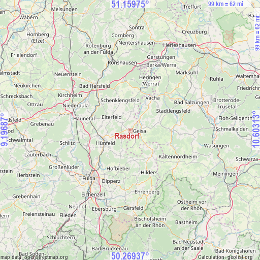
Rasdorf GPS coordinates[2]
50° 43' 0.012" North, 9° 54' 0" East
| Map corner | latitude | longitude |
|---|---|---|
| Upper-left | 51.15975°, | 9.19687° |
| Center: | 50.71667°, | 9.9° |
| Lower-right: | 50.26937°, | 10.60313° |
| Map W x H: | 99×99 km | = 61.5×61.5mi |
| max Lat: | 55.01917° ⇑47.5% North |
| Rasdorf: | 50.71667° |
| min Lat: | ⇓52.5% South 47.40724° |
| min Long | Rasdorf | max Long |
| 5.92978° | 9.9° | 14.98853° |
| W 48.5%⇐ | ⇒51.5% E |
Elevation
Elevation of Rasdorf is 333 m = 1093 ft, and this is 83.9 m = 275 ft above average elevation for this country.
| Max E: |
1256 m = 4121 ft | 33.3% |
| Rasdorf | 333 m 1093 ft | |
| Avg. | 249.1 m = 817 ft | |
Min E: |
-5 m = -16 ft | 66.7% |
See also: Germany elevation on elevation.city.
Geographical zone
Rasdorf is located in North temperate zone (between Tropic of Cancer and the Arctic Circle). Distance of this North polar circle is 1762 km =1094.9 mi to North.| Distance of | km | miles | from Rasdorf |
|---|---|---|---|
| North Pole | 4367.9 | 2714.1 | to North |
| Arctic Circle | 1762 | 1094.9 | to North |
| Tropic Cancer | 3033.2 | 1884.7 | to South |
| Equator | 5639.2 | 3504 | to South |


Nearby cities:
15 places around Rasdorf: (largest is in red/bold)
• Andenhausen
13 km =8.1 mi,  115°
115°
• Burghaun
12.6 km =7.8 mi,  259°
259°
• Buttlar
5.9 km =3.7 mi,  39°
39°
• Eiterfeld
9 km =5.6 mi,  308°
308°
• Geisa
3.6 km =2.2 mi,  93°
93°
• Hünfeld
10.2 km =6.3 mi,  246°
246°
• Martinroda
14.9 km =9.3 mi,  51°
51°
• Oechsen
11.9 km =7.4 mi,  74°
74°
• Schenklengsfeld
11.7 km =7.3 mi,  342°
342°
• Schleid
5 km =3.1 mi,  111°
111°
• Tann
12 km =7.5 mi,  133°
133°
• Unterbreizbach
12.6 km =7.8 mi,  27°
27°
• Vacha
15 km =9.3 mi, 34°
• Völkershausen
14 km =8.7 mi, 48°
• Wölferbütt
11.9 km =7.4 mi,  62°
62°
Sources, notices
• [Note1] Compared only with cities in Germany existing in our database
• [Src1] Map data: © OpenStreetMap contributors (CC-BY-SA)
• [Src2] Other city data from geonames.org with taken over terms of usage.
• [Src3] Geographical zone / Annual Mean Temperature by Robert A. Rohde @ Wikipedia
