Hünfeld geodata
Hünfeld (Hesse) is a populated place; located in Germany in Europe/Berlin (GMT+2) time zone. With population of 16,323 people, there are 972 cities with bigger population in this country. Compared to other cities in Germany, 51.5% of cities are located further ↓South; 53.3% of cities are located further →East and 57.8% of cities have lower elevation than Hünfeld. Note1
Administrative division(s):
- Level 1: Hesse
- Level 2: Regierungsbezirk Kassel
- Level 3: Landkreis Fulda
- Level 4: Hünfeld


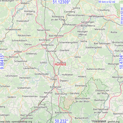
Hünfeld GPS coordinates[2]
50° 40' 46.776" North, 9° 46' 2.172" East
| Map corner | latitude | longitude |
|---|---|---|
| Upper-left | 51.12309°, | 9.06415° |
| Center: | 50.67966°, | 9.76727° |
| Lower-right: | 50.232°, | 10.4704° |
| Map W x H: | 99.1×99.1 km | = 61.6×61.6mi |
| max Lat: | 55.01917° ⇑48.5% North |
| Hünfeld: | 50.67966° |
| min Lat: | ⇓51.5% South 47.40724° |
| min Long | Hünfeld | max Long |
| 5.92978° | 9.76727° | 14.98853° |
| W 46.7%⇐ | ⇒53.3% E |
Elevation
Elevation of Hünfeld is 277 m = 909 ft, and this is 27.9 m = 92 ft above average elevation for this country.
| Max E: |
1256 m = 4121 ft | 42.2% |
| Hünfeld | 277 m 909 ft | |
| Avg. | 249.1 m = 817 ft | |
Min E: |
-5 m = -16 ft | 57.8% |
See also: Germany elevation on elevation.city.
Geographical zone
Hünfeld is located in North temperate zone (between Tropic of Cancer and the Arctic Circle). Distance of this North polar circle is 1766.1 km =1097.4 mi to North.| Distance of | km | miles | from Hünfeld |
|---|---|---|---|
| North Pole | 4372 | 2716.6 | to North |
| Arctic Circle | 1766.1 | 1097.4 | to North |
| Tropic Cancer | 3029.1 | 1882.2 | to South |
| Equator | 5635 | 3501.4 | to South |


Nearby cities:
15 places around Hünfeld: (largest is in red/bold)
• Burghaun
3.6 km =2.2 mi,  302°
302°
• Buttlar
15.7 km =9.8 mi,  56°
56°
• Dipperz
15.3 km =9.5 mi,  172°
172°
• Eiterfeld
9.9 km =6.2 mi,  13°
13°
• Fulda
15.6 km =9.7 mi,  204°
204°
• Geisa
13.5 km =8.4 mi,  73°
73°
• Großenlüder
18.6 km =11.6 mi,  238°
238°
• Hofbieber
11.4 km =7.1 mi,  155°
155°
• Künzell
15.5 km =9.6 mi,  193°
193°
• Niederaula
17.8 km =11.1 mi,  318°
318°
• Rasdorf
10.2 km =6.3 mi, 66°
• Schenklengsfeld
16.3 km =10.1 mi,  20°
20°
• Schleid
14.2 km =8.8 mi,  80°
80°
• Schlitz
14.5 km =9 mi,  267°
267°
• Tann
18.5 km =11.5 mi,  102°
102°
Sources, notices
• [Note1] Compared only with cities in Germany existing in our database
• [Src1] Map data: © OpenStreetMap contributors (CC-BY-SA)
• [Src2] Other city data from geonames.org with taken over terms of usage.
• [Src3] Geographical zone / Annual Mean Temperature by Robert A. Rohde @ Wikipedia
