Nanzdietschweiler geodata
Nanzdietschweiler (Rheinland-Pfalz) is a seat of a fourth-order administrative division; located in Germany in Europe/Berlin (GMT+2) time zone. With population of 1,276 people, there are 6375 cities with bigger population in this country. Compared to other cities in Germany, 76.5% of cities are located further ↑North; 88% of cities are located further →East and 58.3% of cities have lower elevation than Nanzdietschweiler. Note1
Administrative division(s):
- Level 1: Rheinland-Pfalz
- Level 3: Landkreis Kusel
- Level 4: Nanzdietschweiler


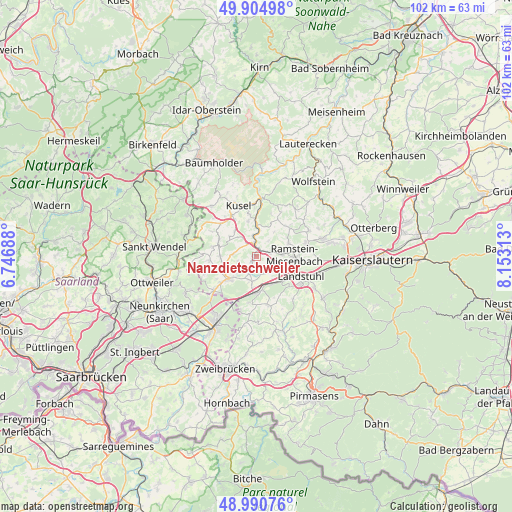
Nanzdietschweiler GPS coordinates[2]
49° 27' 0" North, 7° 27' 0" East
| Map corner | latitude | longitude |
|---|---|---|
| Upper-left | 49.90498°, | 6.74688° |
| Center: | 49.45°, | 7.45° |
| Lower-right: | 48.99076°, | 8.15313° |
| Map W x H: | 101.7×101.7 km | = 63.2×63.2mi |
| max Lat: | 55.01917° ⇑76.5% North |
| Nanzdietschweiler: | 49.45° |
| min Lat: | ⇓23.5% South 47.40724° |
| min Long | Nanzdietschweil | max Long |
| 5.92978° | 7.45° | 14.98853° |
| W 12%⇐ | ⇒88% E |
Elevation
Elevation of Nanzdietschweiler is 280 m = 919 ft, and this is 30.9 m = 101 ft above average elevation for this country.
| Max E: |
1256 m = 4121 ft | 41.7% |
| Nanzdietschweiler | 280 m 919 ft | |
| Avg. | 249.1 m = 817 ft | |
Min E: |
-5 m = -16 ft | 58.3% |
See also: Germany elevation on elevation.city.
Geographical zone
Nanzdietschweiler is located in North temperate zone (between Tropic of Cancer and the Arctic Circle). Distance of this North polar circle is 1902.8 km =1182.3 mi to North.| Distance of | km | miles | from Nanzdietschweiler |
|---|---|---|---|
| North Pole | 4508.7 | 2801.6 | to North |
| Arctic Circle | 1902.8 | 1182.3 | to North |
| Tropic Cancer | 2892.4 | 1797.3 | to South |
| Equator | 5498.3 | 3416.5 | to South |


Nearby cities:
15 places around Nanzdietschweiler: (largest is in red/bold)
• Brücken
6.8 km =4.2 mi,  252°
252°
• Börsborn
4.1 km =2.5 mi,  242°
242°
• Glan-Münchweiler
2.5 km =1.6 mi,  346°
346°
• Gries
5.2 km =3.2 mi,  224°
224°
• Hauptstuhl
6.1 km =3.8 mi,  156°
156°
• Hütschenhausen
4.4 km =2.7 mi,  146°
146°
• Kottweiler-Schwanden
7.1 km =4.4 mi,  58°
58°
• Matzenbach
5.7 km =3.5 mi,  12°
12°
• Neunkirchen am Potzberg
6.1 km =3.8 mi,  23°
23°
• Niedermohr
1.7 km =1.1 mi,  54°
54°
• Ohmbach
7.2 km =4.5 mi,  270°
270°
• Quirnbach
3.5 km =2.2 mi,  322°
322°
• Rehweiler
4 km =2.5 mi, 351°
• Steinwenden
5.6 km =3.5 mi,  81°
81°
• Wahnwegen
6.6 km =4.1 mi,  305°
305°
Sources, notices
• [Note1] Compared only with cities in Germany existing in our database
• [Src1] Map data: © OpenStreetMap contributors (CC-BY-SA)
• [Src2] Other city data from geonames.org with taken over terms of usage.
• [Src3] Geographical zone / Annual Mean Temperature by Robert A. Rohde @ Wikipedia
