Bayerbach geodata
Bayerbach (Bavaria) is a populated place; located in Germany in Europe/Berlin (GMT+2) time zone. With population of 1,733 people, there are 5455 cities with bigger population in this country. Compared to other cities in Germany, 86.4% of cities are located further ↑North; 85.8% of cities are located further ←West and 77.2% of cities have lower elevation than Bayerbach. Note1
Administrative division(s):
- Level 1: Bavaria
- Level 2: Lower Bavaria
- Level 3: Landkreis Landshut
- Level 4: Bayerbach b.Ergoldsbach


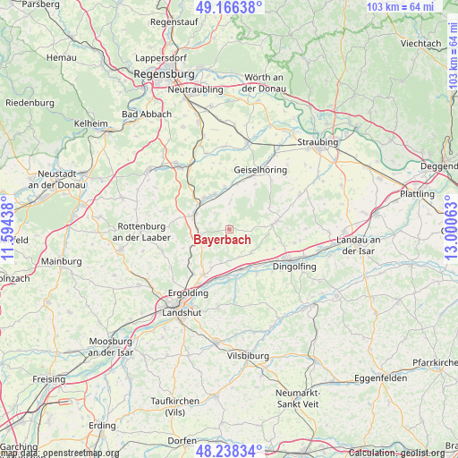
Bayerbach GPS coordinates[2]
48° 42' 16.2" North, 12° 17' 51" East
| Map corner | latitude | longitude |
|---|---|---|
| Upper-left | 49.16638°, | 11.59438° |
| Center: | 48.7045°, | 12.2975° |
| Lower-right: | 48.23834°, | 13.00063° |
| Map W x H: | 103.2×103.2 km | = 64.1×64.1mi |
| max Lat: | 55.01917° ⇑86.4% North |
| Bayerbach: | 48.7045° |
| min Lat: | ⇓13.6% South 47.40724° |
| min Long | Bayerbach | max Long |
| 5.92978° | 12.2975° | 14.98853° |
| W 85.8%⇐ | ⇒14.2% E |
Elevation
Elevation of Bayerbach is 414 m = 1358 ft, and this is 164.9 m = 541 ft above average elevation for this country.
| Max E: |
1256 m = 4121 ft | 22.8% |
| Bayerbach | 414 m 1358 ft | |
| Avg. | 249.1 m = 817 ft | |
Min E: |
-5 m = -16 ft | 77.2% |
See also: Germany elevation on elevation.city.
Geographical zone
Bayerbach is located in North temperate zone (between Tropic of Cancer and the Arctic Circle). Distance of this North polar circle is 1985.7 km =1233.9 mi to North.| Distance of | km | miles | from Bayerbach |
|---|---|---|---|
| North Pole | 4591.6 | 2853.1 | to North |
| Arctic Circle | 1985.7 | 1233.9 | to North |
| Tropic Cancer | 2809.5 | 1745.7 | to South |
| Equator | 5415.4 | 3365 | to South |


Nearby cities:
15 places around Bayerbach: (largest is in red/bold)
• Buch
11.4 km =7.1 mi,  239°
239°
• Ergoldsbach
7 km =4.3 mi,  259°
259°
• Essenbach
11.7 km =7.3 mi,  209°
209°
• Geiselhöring
15.2 km =9.4 mi,  28°
28°
• Hohenthann
15.8 km =9.8 mi,  252°
252°
• Laberweinting
10.7 km =6.6 mi,  7°
7°
• Loiching
14 km =8.7 mi,  134°
134°
• Mallersdorf-Pfaffenberg
8.4 km =5.2 mi,  324°
324°
• Mengkofen
10.6 km =6.6 mi,  81°
81°
• Moosthenning
15 km =9.3 mi,  101°
101°
• Niederaichbach
11.7 km =7.3 mi,  173°
173°
• Niederviehbach
11.6 km =7.2 mi,  147°
147°
• Postau
6.6 km =4.1 mi,  156°
156°
• Weng
7.3 km =4.5 mi, 134°
• Wörth an der Isar
9.6 km =6 mi, 161°
Sources, notices
• [Note1] Compared only with cities in Germany existing in our database
• [Src1] Map data: © OpenStreetMap contributors (CC-BY-SA)
• [Src2] Other city data from geonames.org with taken over terms of usage.
• [Src3] Geographical zone / Annual Mean Temperature by Robert A. Rohde @ Wikipedia
