Postau geodata
Postau (Bavaria) is a seat of a fourth-order administrative division; located in Germany in Europe/Berlin (GMT+2) time zone. With population of 1,644 people, there are 5615 cities with bigger population in this country. Compared to other cities in Germany, 87.2% of cities are located further ↑North; 86.1% of cities are located further ←West and 72.8% of cities have lower elevation than Postau. Note1
Administrative division(s):
- Level 1: Bavaria
- Level 2: Lower Bavaria
- Level 3: Landkreis Landshut
- Level 4: Postau


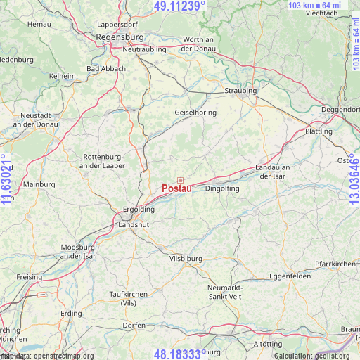
Postau GPS coordinates[2]
48° 39' 0" North, 12° 19' 59.988" East
| Map corner | latitude | longitude |
|---|---|---|
| Upper-left | 49.11239°, | 11.63021° |
| Center: | 48.65°, | 12.33333° |
| Lower-right: | 48.18333°, | 13.03646° |
| Map W x H: | 103.3×103.3 km | = 64.2×64.2mi |
| max Lat: | 55.01917° ⇑87.2% North |
| Postau: | 48.65° |
| min Lat: | ⇓12.8% South 47.40724° |
| min Long | Postau | max Long |
| 5.92978° | 12.33333° | 14.98853° |
| W 86.1%⇐ | ⇒13.9% E |
Elevation
Elevation of Postau is 380 m = 1247 ft, and this is 130.9 m = 429 ft above average elevation for this country.
| Max E: |
1256 m = 4121 ft | 27.2% |
| Postau | 380 m 1247 ft | |
| Avg. | 249.1 m = 817 ft | |
Min E: |
-5 m = -16 ft | 72.8% |
See also: Germany elevation on elevation.city.
Geographical zone
Postau is located in North temperate zone (between Tropic of Cancer and the Arctic Circle). Distance of this North polar circle is 1991.8 km =1237.6 mi to North.| Distance of | km | miles | from Postau |
|---|---|---|---|
| North Pole | 4597.7 | 2856.9 | to North |
| Arctic Circle | 1991.8 | 1237.6 | to North |
| Tropic Cancer | 2803.5 | 1742 | to South |
| Equator | 5409.4 | 3361.2 | to South |


Nearby cities:
15 places around Postau: (largest is in red/bold)
• Adlkofen
12.2 km =7.6 mi,  203°
203°
• Bayerbach
6.6 km =4.1 mi,  336°
336°
• Buch
12.5 km =7.8 mi,  271°
271°
• Dingolfing
11.7 km =7.3 mi,  94°
94°
• Ergolding
14.5 km =9 mi,  235°
235°
• Ergoldsbach
10.6 km =6.6 mi,  296°
296°
• Essenbach
9.4 km =5.8 mi, 244°
• Loiching
8.2 km =5.1 mi,  116°
116°
• Mengkofen
11 km =6.8 mi,  45°
45°
• Moosthenning
12.4 km =7.7 mi,  76°
76°
• Niederaichbach
5.7 km =3.5 mi,  192°
192°
• Niederviehbach
5.2 km =3.2 mi,  135°
135°
• Stallwang
12.7 km =7.9 mi,  216°
216°
• Weng
2.8 km =1.7 mi,  69°
69°
• Wörth an der Isar
3 km =1.9 mi,  171°
171°
Sources, notices
• [Note1] Compared only with cities in Germany existing in our database
• [Src1] Map data: © OpenStreetMap contributors (CC-BY-SA)
• [Src2] Other city data from geonames.org with taken over terms of usage.
• [Src3] Geographical zone / Annual Mean Temperature by Robert A. Rohde @ Wikipedia
