Neuhausen geodata
Neuhausen (Saxony) is a populated place; located in Germany in Europe/Berlin (GMT+2) time zone. With population of 3,325 people, there are 3738 cities with bigger population in this country. Compared to other cities in Germany, 51.4% of cities are located further ↓South; 95.5% of cities are located further ←West and 92.1% of cities have lower elevation than Neuhausen. Note1
Administrative division(s):
- Level 1: Saxony
- Level 3: Landkreis Mittelsachsen
- Level 4: Neuhausen/Erzgeb.


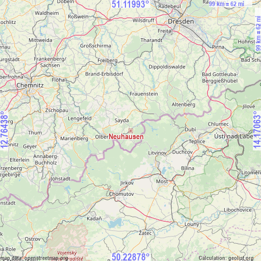
Neuhausen GPS coordinates[2]
50° 40' 35.292" North, 13° 28' 3" East
| Map corner | latitude | longitude |
|---|---|---|
| Upper-left | 51.11993°, | 12.76438° |
| Center: | 50.67647°, | 13.4675° |
| Lower-right: | 50.22878°, | 14.17063° |
| Map W x H: | 99.1×99.1 km | = 61.6×61.6mi |
| max Lat: | 55.01917° ⇑48.6% North |
| Neuhausen: | 50.67647° |
| min Lat: | ⇓51.4% South 47.40724° |
| min Long | Neuhausen | max Long |
| 5.92978° | 13.4675° | 14.98853° |
| W 95.5%⇐ | ⇒4.5% E |
Elevation
Elevation of Neuhausen is 543 m = 1781 ft, and this is 293.9 m = 964 ft above average elevation for this country.
| Max E: |
1256 m = 4121 ft | 7.9% |
| Neuhausen | 543 m 1781 ft | |
| Avg. | 249.1 m = 817 ft | |
Min E: |
-5 m = -16 ft | 92.1% |
See also: Germany elevation on elevation.city.
Geographical zone
Neuhausen is located in North temperate zone (between Tropic of Cancer and the Arctic Circle). Distance of this North polar circle is 1766.5 km =1097.7 mi to North.| Distance of | km | miles | from Neuhausen |
|---|---|---|---|
| North Pole | 4372.4 | 2716.9 | to North |
| Arctic Circle | 1766.5 | 1097.7 | to North |
| Tropic Cancer | 3028.8 | 1882 | to South |
| Equator | 5634.7 | 3501.2 | to South |


Nearby cities:
15 places around Neuhausen: (largest is in red/bold)
• Deutschneudorf
6.6 km =4.1 mi,  180°
180°
• Dorfchemnitz
10.1 km =6.3 mi,  352°
352°
• Frauenstein
14.9 km =9.3 mi,  19°
19°
• Großhartmannsdorf
16.7 km =10.4 mi,  325°
325°
• Heidersdorf
4.8 km =3 mi,  279°
279°
• Lichtenberg
17.9 km =11.1 mi, 350°
• Mulda
15.1 km =9.4 mi, 345°
• Olbernhau
9 km =5.6 mi,  257°
257°
• Pfaffroda
8.7 km =5.4 mi,  287°
287°
• Pobershau
18 km =11.2 mi, 257°
• Pockau
16.7 km =10.4 mi, 279°
• Rechenberg-Bienenmühle
8.3 km =5.2 mi,  34°
34°
• Sayda
5 km =3.1 mi,  320°
320°
• Seiffen
3.2 km =2 mi,  202°
202°
• Zöblitz
16.9 km =10.5 mi, 263°
Sources, notices
• [Note1] Compared only with cities in Germany existing in our database
• [Src1] Map data: © OpenStreetMap contributors (CC-BY-SA)
• [Src2] Other city data from geonames.org with taken over terms of usage.
• [Src3] Geographical zone / Annual Mean Temperature by Robert A. Rohde @ Wikipedia
