Lichtenberg geodata
Lichtenberg (Saxony) is a populated place; located in Germany in Europe/Berlin (GMT+2) time zone. With population of 3,060 people, there are 3948 cities with bigger population in this country. Compared to other cities in Germany, 54.9% of cities are located further ↓South; 95.3% of cities are located further ←West and 77.4% of cities have lower elevation than Lichtenberg. Note1
Administrative division(s):
- Level 1: Saxony
- Level 3: Landkreis Mittelsachsen
- Level 4: Lichtenberg/Erzgeb.


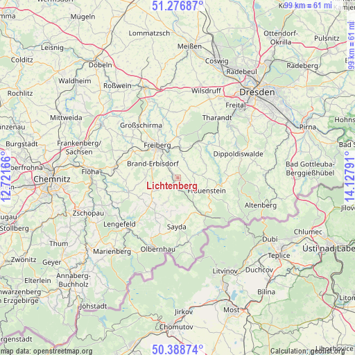
Lichtenberg GPS coordinates[2]
50° 50' 5.712" North, 13° 25' 29.208" East
| Map corner | latitude | longitude |
|---|---|---|
| Upper-left | 51.27687°, | 12.72166° |
| Center: | 50.83492°, | 13.42478° |
| Lower-right: | 50.38874°, | 14.12791° |
| Map W x H: | 98.8×98.7 km | = 61.4×61.3mi |
| max Lat: | 55.01917° ⇑45.1% North |
| Lichtenberg: | 50.83492° |
| min Lat: | ⇓54.9% South 47.40724° |
| min Long | Lichtenberg | max Long |
| 5.92978° | 13.42478° | 14.98853° |
| W 95.3%⇐ | ⇒4.7% E |
Elevation
Elevation of Lichtenberg is 415 m = 1362 ft, and this is 165.9 m = 544 ft above average elevation for this country.
| Max E: |
1256 m = 4121 ft | 22.6% |
| Lichtenberg | 415 m 1362 ft | |
| Avg. | 249.1 m = 817 ft | |
Min E: |
-5 m = -16 ft | 77.4% |
See also: Germany elevation on elevation.city.
Geographical zone
Lichtenberg is located in North temperate zone (between Tropic of Cancer and the Arctic Circle). Distance of this North polar circle is 1748.9 km =1086.7 mi to North.| Distance of | km | miles | from Lichtenberg |
|---|---|---|---|
| North Pole | 4354.7 | 2705.9 | to North |
| Arctic Circle | 1748.9 | 1086.7 | to North |
| Tropic Cancer | 3046.4 | 1892.9 | to South |
| Equator | 5652.3 | 3512.2 | to South |


Nearby cities:
15 places around Lichtenberg: (largest is in red/bold)
• Brand-Erbisdorf
8 km =5 mi,  296°
296°
• Dorfchemnitz
7.8 km =4.8 mi,  166°
166°
• Dorfhain
14.8 km =9.2 mi,  42°
42°
• Eppendorf
14 km =8.7 mi,  253°
253°
• Frauenstein
8.7 km =5.4 mi,  114°
114°
• Freiberg
10.4 km =6.5 mi,  324°
324°
• Großhartmannsdorf
7.5 km =4.7 mi,  238°
238°
• Halsbrücke
13.8 km =8.6 mi,  337°
337°
• Mulda
3.1 km =1.9 mi,  193°
193°
• Niederschöna
14.7 km =9.1 mi,  358°
358°
• Obercunnersdorf
13.2 km =8.2 mi,  46°
46°
• Oberschöna
13.9 km =8.6 mi, 300°
• Pretzschendorf
8.3 km =5.2 mi,  58°
58°
• Rechenberg-Bienenmühle
13.3 km =8.3 mi,  144°
144°
• Sayda
13.8 km =8.6 mi,  180°
180°
Sources, notices
• [Note1] Compared only with cities in Germany existing in our database
• [Src1] Map data: © OpenStreetMap contributors (CC-BY-SA)
• [Src2] Other city data from geonames.org with taken over terms of usage.
• [Src3] Geographical zone / Annual Mean Temperature by Robert A. Rohde @ Wikipedia
