Hütschenhausen geodata
Hütschenhausen (Rheinland-Pfalz) is a seat of a fourth-order administrative division; located in Germany in Europe/Berlin (GMT+2) time zone. With population of 4,039 people, there are 3277 cities with bigger population in this country. Compared to other cities in Germany, 77% of cities are located further ↑North; 87.4% of cities are located further →East and 50.3% of cities have lower elevation than Hütschenhausen. Note1
Administrative division(s):
- Level 1: Rheinland-Pfalz
- Level 3: Landkreis Kaiserslautern
- Level 4: Hütschenhausen


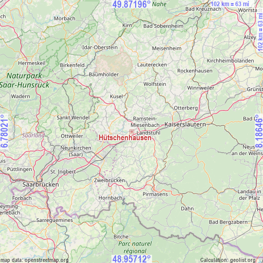
Hütschenhausen GPS coordinates[2]
49° 25' 0.012" North, 7° 28' 59.988" East
| Map corner | latitude | longitude |
|---|---|---|
| Upper-left | 49.87196°, | 6.78021° |
| Center: | 49.41667°, | 7.48333° |
| Lower-right: | 48.95712°, | 8.18646° |
| Map W x H: | 101.7×101.7 km | = 63.2×63.2mi |
| max Lat: | 55.01917° ⇑77% North |
| Hütschenhausen: | 49.41667° |
| min Lat: | ⇓23% South 47.40724° |
| min Long | Hütschenhausen | max Long |
| 5.92978° | 7.48333° | 14.98853° |
| W 12.6%⇐ | ⇒87.4% E |
Elevation
Elevation of Hütschenhausen is 227 m = 745 ft, and this is 22.1 m = 73 ft below average elevation for this country.
| Max E: |
1256 m = 4121 ft | 49.7% |
| Avg. | 249.1 m = 817 ft | |
| Hütschenhausen | 227 m = 745 ft | |
Min E: |
-5 m = -16 ft | 50.3% |
See also: Germany elevation on elevation.city.
Geographical zone
Hütschenhausen is located in North temperate zone (between Tropic of Cancer and the Arctic Circle). Distance of this North polar circle is 1906.6 km =1184.7 mi to North.| Distance of | km | miles | from Hütschenhausen |
|---|---|---|---|
| North Pole | 4512.4 | 2803.9 | to North |
| Arctic Circle | 1906.6 | 1184.7 | to North |
| Tropic Cancer | 2888.7 | 1795 | to South |
| Equator | 5494.6 | 3414.2 | to South |


Nearby cities:
15 places around Hütschenhausen: (largest is in red/bold)
• Bruchmühlbach-Miesau
5.2 km =3.2 mi,  224°
224°
• Börsborn
6.3 km =3.9 mi,  287°
287°
• Gerhardsbrunn
7.8 km =4.8 mi,  161°
161°
• Glan-Münchweiler
6.9 km =4.3 mi,  334°
334°
• Gries
6 km =3.7 mi,  270°
270°
• Hauptstuhl
1.9 km =1.2 mi,  180°
180°
• Lambsborn
6.6 km =4.1 mi,  213°
213°
• Landstuhl
6.3 km =3.9 mi,  93°
93°
• Langwieden
3.9 km =2.4 mi, 161°
• Martinshöhe
5.6 km =3.5 mi, 180°
• Mittelbrunn
7.4 km =4.6 mi,  139°
139°
• Nanzdietschweiler
4.4 km =2.7 mi, 326°
• Niedermohr
4.8 km =3 mi,  348°
348°
• Ramstein-Miesenbach
6.1 km =3.8 mi,  59°
59°
• Steinwenden
5.5 km =3.4 mi,  35°
35°
Sources, notices
• [Note1] Compared only with cities in Germany existing in our database
• [Src1] Map data: © OpenStreetMap contributors (CC-BY-SA)
• [Src2] Other city data from geonames.org with taken over terms of usage.
• [Src3] Geographical zone / Annual Mean Temperature by Robert A. Rohde @ Wikipedia
