Mönchsroth geodata
Mönchsroth (Bavaria) is a seat of a fourth-order administrative division; located in Germany in Europe/Berlin (GMT+2) time zone. With population of 1,566 people, there are 5752 cities with bigger population in this country. Compared to other cities in Germany, 82.8% of cities are located further ↑North; 56.5% of cities are located further ←West and 81.7% of cities have lower elevation than Mönchsroth. Note1
Administrative division(s):
- Level 1: Bavaria
- Level 2: Regierungsbezirk Mittelfranken
- Level 3: Landkreis Ansbach
- Level 4: Mönchsroth


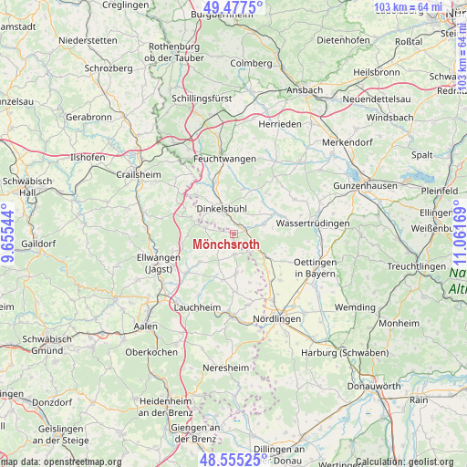
Mönchsroth GPS coordinates[2]
49° 1' 6.636" North, 10° 21' 30.816" East
| Map corner | latitude | longitude |
|---|---|---|
| Upper-left | 49.4775°, | 9.65544° |
| Center: | 49.01851°, | 10.35856° |
| Lower-right: | 48.55525°, | 11.06169° |
| Map W x H: | 102.5×102.5 km | = 63.7×63.7mi |
| max Lat: | 55.01917° ⇑82.8% North |
| Mönchsroth: | 49.01851° |
| min Lat: | ⇓17.2% South 47.40724° |
| min Long | Mönchsroth | max Long |
| 5.92978° | 10.35856° | 14.98853° |
| W 56.5%⇐ | ⇒43.5% E |
Elevation
Elevation of Mönchsroth is 444 m = 1457 ft, and this is 194.9 m = 639 ft above average elevation for this country.
| Max E: |
1256 m = 4121 ft | 18.3% |
| Mönchsroth | 444 m 1457 ft | |
| Avg. | 249.1 m = 817 ft | |
Min E: |
-5 m = -16 ft | 81.7% |
See also: Germany elevation on elevation.city.
Geographical zone
Mönchsroth is located in North temperate zone (between Tropic of Cancer and the Arctic Circle). Distance of this North polar circle is 1950.8 km =1212.2 mi to North.| Distance of | km | miles | from Mönchsroth |
|---|---|---|---|
| North Pole | 4556.7 | 2831.4 | to North |
| Arctic Circle | 1950.8 | 1212.2 | to North |
| Tropic Cancer | 2844.4 | 1767.4 | to South |
| Equator | 5450.3 | 3386.7 | to South |


Nearby cities:
15 places around Mönchsroth: (largest is in red/bold)
• Dinkelsbühl
6.3 km =3.9 mi,  333°
333°
• Dürrwangen
10.1 km =6.3 mi,  10°
10°
• Ellenberg
10.3 km =6.4 mi,  268°
268°
• Fremdingen
8.9 km =5.5 mi,  125°
125°
• Gerolfingen
11.8 km =7.3 mi,  70°
70°
• Langfurth
11.5 km =7.1 mi,  37°
37°
• Marktoffingen
13.2 km =8.2 mi,  141°
141°
• Schopfloch
11.8 km =7.3 mi,  341°
341°
• Stödtlen
4.7 km =2.9 mi,  244°
244°
• Tannhausen
4.4 km =2.7 mi,  177°
177°
• Unterschneidheim
9.5 km =5.9 mi, 176°
• Weiltingen
7.1 km =4.4 mi, 71°
• Wilburgstetten
2.7 km =1.7 mi,  76°
76°
• Wittelshofen
10.1 km =6.3 mi,  62°
62°
• Wört
6.4 km =4 mi,  281°
281°
Sources, notices
• [Note1] Compared only with cities in Germany existing in our database
• [Src1] Map data: © OpenStreetMap contributors (CC-BY-SA)
• [Src2] Other city data from geonames.org with taken over terms of usage.
• [Src3] Geographical zone / Annual Mean Temperature by Robert A. Rohde @ Wikipedia
