Tannhausen geodata
Tannhausen (Baden-Württemberg) is a seat of a fourth-order administrative division; located in Germany in Europe/Berlin (GMT+2) time zone. With population of 1,868 people, there are 5250 cities with bigger population in this country. Compared to other cities in Germany, 83.2% of cities are located further ↑North; 56.5% of cities are located further ←West and 90.2% of cities have lower elevation than Tannhausen. Note1
Administrative division(s):
- Level 1: Baden-Württemberg
- Level 2: Regierungsbezirk Stuttgart
- Level 3: Ostalbkreis
- Level 4: Tannhausen


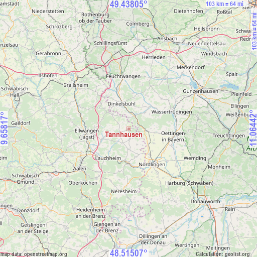
Tannhausen GPS coordinates[2]
48° 58' 43.32" North, 10° 21' 40.644" East
| Map corner | latitude | longitude |
|---|---|---|
| Upper-left | 49.43805°, | 9.65817° |
| Center: | 48.9787°, | 10.36129° |
| Lower-right: | 48.51507°, | 11.06442° |
| Map W x H: | 102.6×102.6 km | = 63.8×63.8mi |
| max Lat: | 55.01917° ⇑83.2% North |
| Tannhausen: | 48.9787° |
| min Lat: | ⇓16.8% South 47.40724° |
| min Long | Tannhausen | max Long |
| 5.92978° | 10.36129° | 14.98853° |
| W 56.5%⇐ | ⇒43.5% E |
Elevation
Elevation of Tannhausen is 517 m = 1696 ft, and this is 267.9 m = 879 ft above average elevation for this country.
| Max E: |
1256 m = 4121 ft | 9.8% |
| Tannhausen | 517 m 1696 ft | |
| Avg. | 249.1 m = 817 ft | |
Min E: |
-5 m = -16 ft | 90.2% |
See also: Germany elevation on elevation.city.
Geographical zone
Tannhausen is located in North temperate zone (between Tropic of Cancer and the Arctic Circle). Distance of this North polar circle is 1955.3 km =1215 mi to North.| Distance of | km | miles | from Tannhausen |
|---|---|---|---|
| North Pole | 4561.1 | 2834.1 | to North |
| Arctic Circle | 1955.3 | 1215 | to North |
| Tropic Cancer | 2840 | 1764.7 | to South |
| Equator | 5445.9 | 3383.9 | to South |


Nearby cities:
15 places around Tannhausen: (largest is in red/bold)
• Bopfingen
13.4 km =8.3 mi,  182°
182°
• Dinkelsbühl
10.5 km =6.5 mi,  343°
343°
• Ellenberg
11.4 km =7.1 mi,  291°
291°
• Fremdingen
7.1 km =4.4 mi,  95°
95°
• Kirchheim am Ries
11.4 km =7.1 mi,  165°
165°
• Maihingen
11.5 km =7.1 mi,  119°
119°
• Marktoffingen
9.9 km =6.2 mi,  126°
126°
• Mönchsroth
4.4 km =2.7 mi,  357°
357°
• Stödtlen
5.1 km =3.2 mi,  297°
297°
• Unterschneidheim
5.1 km =3.2 mi, 175°
• Wallerstein
13.2 km =8.2 mi,  140°
140°
• Weiltingen
9.3 km =5.8 mi,  44°
44°
• Wilburgstetten
5.6 km =3.5 mi,  25°
25°
• Wittelshofen
12.7 km =7.9 mi, 43°
• Wört
8.7 km =5.4 mi,  311°
311°
Sources, notices
• [Note1] Compared only with cities in Germany existing in our database
• [Src1] Map data: © OpenStreetMap contributors (CC-BY-SA)
• [Src2] Other city data from geonames.org with taken over terms of usage.
• [Src3] Geographical zone / Annual Mean Temperature by Robert A. Rohde @ Wikipedia
