Mohlsdorf geodata
Mohlsdorf (Thuringia) is a populated place; located in Germany in Europe/Berlin (GMT+2) time zone. With population of 3,049 people, there are 3960 cities with bigger population in this country. Compared to other cities in Germany, 51.3% of cities are located further ↓South; 85.4% of cities are located further ←West and 63.7% of cities have lower elevation than Mohlsdorf. Note1
Administrative division(s):
- Level 1: Thuringia
- Level 3: Landkreis Greiz
- Level 4: Mohlsdorf-Teichwolframsdorf


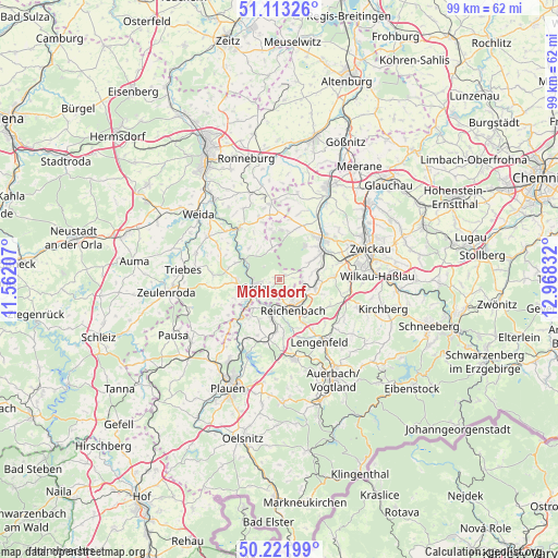
Mohlsdorf GPS coordinates[2]
50° 40' 11.064" North, 12° 15' 54.684" East
| Map corner | latitude | longitude |
|---|---|---|
| Upper-left | 51.11326°, | 11.56207° |
| Center: | 50.66974°, | 12.26519° |
| Lower-right: | 50.22199°, | 12.96832° |
| Map W x H: | 99.1×99.1 km | = 61.6×61.6mi |
| max Lat: | 55.01917° ⇑48.7% North |
| Mohlsdorf: | 50.66974° |
| min Lat: | ⇓51.3% South 47.40724° |
| min Long | Mohlsdorf | max Long |
| 5.92978° | 12.26519° | 14.98853° |
| W 85.4%⇐ | ⇒14.6% E |
Elevation
Elevation of Mohlsdorf is 313 m = 1027 ft, and this is 63.9 m = 210 ft above average elevation for this country.
| Max E: |
1256 m = 4121 ft | 36.3% |
| Mohlsdorf | 313 m 1027 ft | |
| Avg. | 249.1 m = 817 ft | |
Min E: |
-5 m = -16 ft | 63.7% |
See also: Germany elevation on elevation.city.
Geographical zone
Mohlsdorf is located in North temperate zone (between Tropic of Cancer and the Arctic Circle). Distance of this North polar circle is 1767.2 km =1098.1 mi to North.| Distance of | km | miles | from Mohlsdorf |
|---|---|---|---|
| North Pole | 4373.1 | 2717.3 | to North |
| Arctic Circle | 1767.2 | 1098.1 | to North |
| Tropic Cancer | 3028 | 1881.5 | to South |
| Equator | 5633.9 | 3500.7 | to South |


Nearby cities:
15 places around Mohlsdorf: (largest is in red/bold)
• Elsterberg
9.7 km =6 mi,  225°
225°
• Fraureuth
6.9 km =4.3 mi,  60°
60°
• Greiz
4.8 km =3 mi,  254°
254°
• Langenbernsdorf
10.5 km =6.5 mi,  24°
24°
• Leubnitz
8.8 km =5.5 mi,  47°
47°
• Limbach
9.7 km =6 mi,  186°
186°
• Mylau
5.7 km =3.5 mi,  179°
179°
• Netzschkau
6.4 km =4 mi, 193°
• Neugernsdorf
10.7 km =6.6 mi,  299°
299°
• Neumark
6.5 km =4 mi,  99°
99°
• Reichenbach/Vogtland
5.9 km =3.7 mi,  152°
152°
• Reuth
6.8 km =4.2 mi,  210°
210°
• Teichwolframsdorf
5.8 km =3.6 mi,  347°
347°
• Waldkirchen
11.5 km =7.1 mi,  135°
135°
• Werdau
10.7 km =6.6 mi, 46°
Sources, notices
• [Note1] Compared only with cities in Germany existing in our database
• [Src1] Map data: © OpenStreetMap contributors (CC-BY-SA)
• [Src2] Other city data from geonames.org with taken over terms of usage.
• [Src3] Geographical zone / Annual Mean Temperature by Robert A. Rohde @ Wikipedia
