Meißenheim geodata
Meißenheim (Baden-Württemberg) is a seat of a fourth-order administrative division; located in Germany in Europe/Berlin (GMT+2) time zone. With population of 3,636 people, there are 3514 cities with bigger population in this country. Compared to other cities in Germany, 90.1% of cities are located further ↑North; 81.5% of cities are located further →East and 60.7% of cities have higher elevation than Meißenheim. Note1
Administrative division(s):
- Level 1: Baden-Württemberg
- Level 2: Freiburg Region
- Level 3: Ortenaukreis
- Level 4: Meißenheim


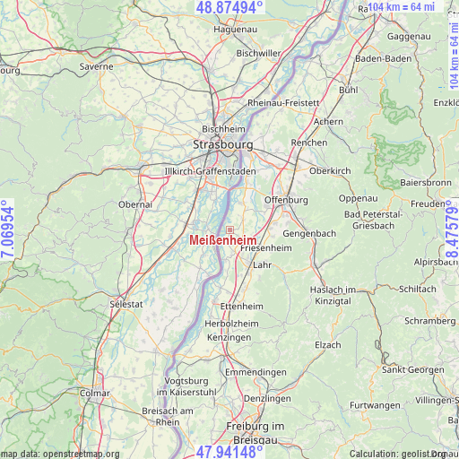
Meißenheim GPS coordinates[2]
48° 24' 37.26" North, 7° 46' 21.576" East
| Map corner | latitude | longitude |
|---|---|---|
| Upper-left | 48.87494°, | 7.06954° |
| Center: | 48.41035°, | 7.77266° |
| Lower-right: | 47.94148°, | 8.47579° |
| Map W x H: | 103.8×103.8 km | = 64.5×64.5mi |
| max Lat: | 55.01917° ⇑90.1% North |
| Meißenheim: | 48.41035° |
| min Lat: | ⇓9.9% South 47.40724° |
| min Long | Meißenheim | max Long |
| 5.92978° | 7.77266° | 14.98853° |
| W 18.5%⇐ | ⇒81.5% E |
Elevation
Elevation of Meißenheim is 147 m = 482 ft, and this is 102.1 m = 335 ft below average elevation for this country.
| Max E: |
1256 m = 4121 ft | 60.7% |
| Avg. | 249.1 m = 817 ft | |
| Meißenheim | 147 m = 482 ft | |
Min E: |
-5 m = -16 ft | 39.3% |
See also: Germany elevation on elevation.city.
Geographical zone
Meißenheim is located in North temperate zone (between Tropic of Cancer and the Arctic Circle). Distance of this North polar circle is 2018.4 km =1254.2 mi to North.| Distance of | km | miles | from Meißenheim |
|---|---|---|---|
| North Pole | 4624.3 | 2873.4 | to North |
| Arctic Circle | 2018.4 | 1254.2 | to North |
| Tropic Cancer | 2776.8 | 1725.4 | to South |
| Equator | 5382.7 | 3344.7 | to South |


Nearby cities:
15 places around Meißenheim: (largest is in red/bold)
• Berghaupten
15.8 km =9.8 mi,  91°
91°
• Friesenheim
9.5 km =5.9 mi,  120°
120°
• Grafenhausen
14 km =8.7 mi,  181°
181°
• Hohberg
13.5 km =8.4 mi,  136°
136°
• Kappel-Grafenhausen
14.1 km =8.8 mi, 181°
• Kippenheim
13.3 km =8.3 mi,  163°
163°
• Lahr
10.5 km =6.5 mi, 137°
• Mahlberg
14.1 km =8.8 mi,  167°
167°
• Offenburg
14.5 km =9 mi,  60°
60°
• Ohlsbach
16.5 km =10.3 mi,  81°
81°
• Ortenberg
15.4 km =9.6 mi,  72°
72°
• Rust
16.2 km =10.1 mi,  190°
190°
• Schutterwald
9.3 km =5.8 mi, 61°
• Schwanau
4.9 km =3 mi, 188°
• Seelbach
16.7 km =10.4 mi,  131°
131°
Sources, notices
• [Note1] Compared only with cities in Germany existing in our database
• [Src1] Map data: © OpenStreetMap contributors (CC-BY-SA)
• [Src2] Other city data from geonames.org with taken over terms of usage.
• [Src3] Geographical zone / Annual Mean Temperature by Robert A. Rohde @ Wikipedia
