Schwanau geodata
Schwanau (Baden-Württemberg) is a seat of a fourth-order administrative division; located in Germany in Europe/Berlin (GMT+2) time zone. With population of 6,858 people, there are 2218 cities with bigger population in this country. Compared to other cities in Germany, 90.5% of cities are located further ↑North; 81.9% of cities are located further →East and 60.1% of cities have higher elevation than Schwanau. Note1
Administrative division(s):
- Level 1: Baden-Württemberg
- Level 2: Freiburg Region
- Level 3: Ortenaukreis
- Level 4: Schwanau


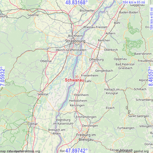
Schwanau GPS coordinates[2]
48° 22' 0.084" North, 7° 45' 44.784" East
| Map corner | latitude | longitude |
|---|---|---|
| Upper-left | 48.83168°, | 7.05932° |
| Center: | 48.36669°, | 7.76244° |
| Lower-right: | 47.89742°, | 8.46557° |
| Map W x H: | 103.9×103.9 km | = 64.6×64.6mi |
| max Lat: | 55.01917° ⇑90.5% North |
| Schwanau: | 48.36669° |
| min Lat: | ⇓9.5% South 47.40724° |
| min Long | Schwanau | max Long |
| 5.92978° | 7.76244° | 14.98853° |
| W 18.1%⇐ | ⇒81.9% E |
Elevation
Elevation of Schwanau is 151 m = 495 ft, and this is 98.1 m = 322 ft below average elevation for this country.
| Max E: |
1256 m = 4121 ft | 60.1% |
| Avg. | 249.1 m = 817 ft | |
| Schwanau | 151 m = 495 ft | |
Min E: |
-5 m = -16 ft | 39.9% |
See also: Germany elevation on elevation.city.
Geographical zone
Schwanau is located in North temperate zone (between Tropic of Cancer and the Arctic Circle). Distance of this North polar circle is 2023.3 km =1257.2 mi to North.| Distance of | km | miles | from Schwanau |
|---|---|---|---|
| North Pole | 4629.2 | 2876.5 | to North |
| Arctic Circle | 2023.3 | 1257.2 | to North |
| Tropic Cancer | 2772 | 1722.4 | to South |
| Equator | 5377.9 | 3341.7 | to South |


Nearby cities:
15 places around Schwanau: (largest is in red/bold)
• Berghaupten
17.1 km =10.6 mi,  75°
75°
• Ettenheim
12.7 km =7.9 mi,  163°
163°
• Friesenheim
8.9 km =5.5 mi,  90°
90°
• Grafenhausen
9.2 km =5.7 mi,  177°
177°
• Herbolzheim
16.5 km =10.3 mi, 176°
• Hohberg
11.3 km =7 mi,  115°
115°
• Kappel-Grafenhausen
9.2 km =5.7 mi, 178°
• Kippenheim
9.2 km =5.7 mi,  149°
149°
• Lahr
8.4 km =5.2 mi,  110°
110°
• Mahlberg
9.7 km =6 mi, 156°
• Meißenheim
4.9 km =3 mi,  8°
8°
• Ringsheim
13.3 km =8.3 mi,  174°
174°
• Rust
11.3 km =7 mi,  190°
190°
• Schutterwald
12.9 km =8 mi,  43°
43°
• Seelbach
14.6 km =9.1 mi, 115°
Sources, notices
• [Note1] Compared only with cities in Germany existing in our database
• [Src1] Map data: © OpenStreetMap contributors (CC-BY-SA)
• [Src2] Other city data from geonames.org with taken over terms of usage.
• [Src3] Geographical zone / Annual Mean Temperature by Robert A. Rohde @ Wikipedia
