Kippenheim geodata
Kippenheim (Baden-Württemberg) is a seat of a fourth-order administrative division; located in Germany in Europe/Berlin (GMT+2) time zone. With population of 5,040 people, there are 2812 cities with bigger population in this country. Compared to other cities in Germany, 91.3% of cities are located further ↑North; 80.5% of cities are located further →East and 57.8% of cities have higher elevation than Kippenheim. Note1
Administrative division(s):
- Level 1: Baden-Württemberg
- Level 2: Freiburg Region
- Level 3: Ortenaukreis
- Level 4: Kippenheim


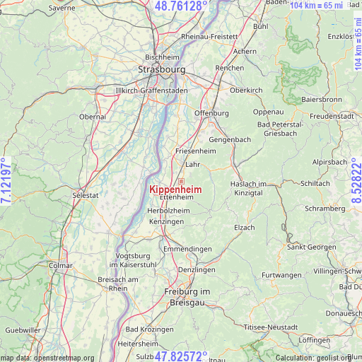
Kippenheim GPS coordinates[2]
48° 17' 44.304" North, 7° 49' 30.36" East
| Map corner | latitude | longitude |
|---|---|---|
| Upper-left | 48.76128°, | 7.12197° |
| Center: | 48.29564°, | 7.8251° |
| Lower-right: | 47.82572°, | 8.52822° |
| Map W x H: | 104×104 km | = 64.6×64.6mi |
| max Lat: | 55.01917° ⇑91.3% North |
| Kippenheim: | 48.29564° |
| min Lat: | ⇓8.7% South 47.40724° |
| min Long | Kippenheim | max Long |
| 5.92978° | 7.8251° | 14.98853° |
| W 19.5%⇐ | ⇒80.5% E |
Elevation
Elevation of Kippenheim is 169 m = 554 ft, and this is 80.1 m = 263 ft below average elevation for this country.
| Max E: |
1256 m = 4121 ft | 57.8% |
| Avg. | 249.1 m = 817 ft | |
| Kippenheim | 169 m = 554 ft | |
Min E: |
-5 m = -16 ft | 42.2% |
See also: Germany elevation on elevation.city.
Geographical zone
Kippenheim is located in North temperate zone (between Tropic of Cancer and the Arctic Circle). Distance of this North polar circle is 2031.2 km =1262.1 mi to North.| Distance of | km | miles | from Kippenheim |
|---|---|---|---|
| North Pole | 4637.1 | 2881.4 | to North |
| Arctic Circle | 2031.2 | 1262.1 | to North |
| Tropic Cancer | 2764.1 | 1717.5 | to South |
| Equator | 5370 | 3336.8 | to South |


Nearby cities:
15 places around Kippenheim: (largest is in red/bold)
• Ettenheim
4.4 km =2.7 mi,  192°
192°
• Friesenheim
9 km =5.6 mi,  28°
28°
• Grafenhausen
4.5 km =2.8 mi,  253°
253°
• Herbolzheim
9.2 km =5.7 mi,  202°
202°
• Hohberg
6.3 km =3.9 mi,  61°
61°
• Kappel-Grafenhausen
4.6 km =2.9 mi, 253°
• Kenzingen
11.8 km =7.3 mi, 200°
• Lahr
5.9 km =3.7 mi, 33°
• Mahlberg
1.3 km =0.8 mi,  218°
218°
• Meißenheim
13.3 km =8.3 mi,  343°
343°
• Ringsheim
6.4 km =4 mi,  213°
213°
• Rust
7.5 km =4.7 mi,  244°
244°
• Schuttertal
9.8 km =6.1 mi,  109°
109°
• Schwanau
9.2 km =5.7 mi,  329°
329°
• Seelbach
8.7 km =5.4 mi,  79°
79°
Sources, notices
• [Note1] Compared only with cities in Germany existing in our database
• [Src1] Map data: © OpenStreetMap contributors (CC-BY-SA)
• [Src2] Other city data from geonames.org with taken over terms of usage.
• [Src3] Geographical zone / Annual Mean Temperature by Robert A. Rohde @ Wikipedia
