Marquartstein geodata
Marquartstein (Bavaria) is a seat of a fourth-order administrative division; located in Germany in Europe/Berlin (GMT+2) time zone. With population of 3,125 people, there are 3896 cities with bigger population in this country. Compared to other cities in Germany, 98.2% of cities are located further ↑North; 87.6% of cities are located further ←West and 92.1% of cities have lower elevation than Marquartstein. Note1
Administrative division(s):
- Level 1: Bavaria
- Level 2: Upper Bavaria
- Level 3: Landkreis Traunstein
- Level 4: Marquartstein


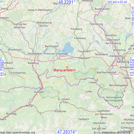
Marquartstein GPS coordinates[2]
47° 45' 30.852" North, 12° 27' 43.884" East
| Map corner | latitude | longitude |
|---|---|---|
| Upper-left | 48.2291°, | 11.75907° |
| Center: | 47.75857°, | 12.46219° |
| Lower-right: | 47.28374°, | 13.16532° |
| Map W x H: | 105.1×105.1 km | = 65.3×65.3mi |
| max Lat: | 55.01917° ⇑98.2% North |
| Marquartstein: | 47.75857° |
| min Lat: | ⇓1.8% South 47.40724° |
| min Long | Marquartstein | max Long |
| 5.92978° | 12.46219° | 14.98853° |
| W 87.6%⇐ | ⇒12.4% E |
Elevation
Elevation of Marquartstein is 544 m = 1785 ft, and this is 294.9 m = 968 ft above average elevation for this country.
| Max E: |
1256 m = 4121 ft | 7.9% |
| Marquartstein | 544 m 1785 ft | |
| Avg. | 249.1 m = 817 ft | |
Min E: |
-5 m = -16 ft | 92.1% |
See also: Germany elevation on elevation.city.
Geographical zone
Marquartstein is located in North temperate zone (between Tropic of Cancer and the Arctic Circle). Distance of this North polar circle is 2090.9 km =1299.2 mi to North.| Distance of | km | miles | from Marquartstein |
|---|---|---|---|
| North Pole | 4696.8 | 2918.5 | to North |
| Arctic Circle | 2090.9 | 1299.2 | to North |
| Tropic Cancer | 2704.3 | 1680.4 | to South |
| Equator | 5310.3 | 3299.7 | to South |


Nearby cities:
15 places around Marquartstein: (largest is in red/bold)
• Aschau im Chiemgau
10.6 km =6.6 mi,  281°
281°
• Bergen
11 km =6.8 mi,  59°
59°
• Bernau am Chiemsee
8.8 km =5.5 mi,  312°
312°
• Chiemsee
12.5 km =7.8 mi,  344°
344°
• Frasdorf
14.2 km =8.8 mi,  290°
290°
• Grabenstätt
11.4 km =7.1 mi,  32°
32°
• Grassau
2.6 km =1.6 mi,  345°
345°
• Prien am Chiemsee
13.9 km =8.6 mi,  321°
321°
• Reit im Winkl
9.1 km =5.7 mi,  175°
175°
• Ruhpolding
14.1 km =8.8 mi,  86°
86°
• Schleching
6.5 km =4 mi,  230°
230°
• Staudach-Egerndach
3.2 km =2 mi, 29°
• Unterwössen
2.8 km =1.7 mi,  173°
173°
• Vachendorf
14.2 km =8.8 mi,  49°
49°
• Übersee
6.7 km =4.2 mi,  13°
13°
Sources, notices
• [Note1] Compared only with cities in Germany existing in our database
• [Src1] Map data: © OpenStreetMap contributors (CC-BY-SA)
• [Src2] Other city data from geonames.org with taken over terms of usage.
• [Src3] Geographical zone / Annual Mean Temperature by Robert A. Rohde @ Wikipedia
