Schleching geodata
Schleching (Bavaria) is a seat of a fourth-order administrative division; located in Germany in Europe/Berlin (GMT+2) time zone. With population of 1,854 people, there are 5269 cities with bigger population in this country. Compared to other cities in Germany, 98.6% of cities are located further ↑North; 86.9% of cities are located further ←West and 93.9% of cities have lower elevation than Schleching. Note1
Administrative division(s):
- Level 1: Bavaria
- Level 2: Upper Bavaria
- Level 3: Landkreis Traunstein
- Level 4: Schleching


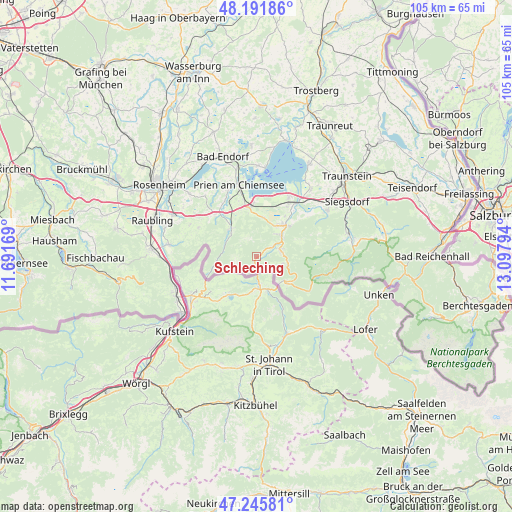
Schleching GPS coordinates[2]
47° 43' 15.528" North, 12° 23' 41.316" East
| Map corner | latitude | longitude |
|---|---|---|
| Upper-left | 48.19186°, | 11.69169° |
| Center: | 47.72098°, | 12.39481° |
| Lower-right: | 47.24581°, | 13.09794° |
| Map W x H: | 105.2×105.2 km | = 65.4×65.4mi |
| max Lat: | 55.01917° ⇑98.6% North |
| Schleching: | 47.72098° |
| min Lat: | ⇓1.4% South 47.40724° |
| min Long | Schleching | max Long |
| 5.92978° | 12.39481° | 14.98853° |
| W 86.9%⇐ | ⇒13.1% E |
Elevation
Elevation of Schleching is 572 m = 1877 ft, and this is 322.9 m = 1059 ft above average elevation for this country.
| Max E: |
1256 m = 4121 ft | 6.1% |
| Schleching | 572 m 1877 ft | |
| Avg. | 249.1 m = 817 ft | |
Min E: |
-5 m = -16 ft | 93.9% |
See also: Germany elevation on elevation.city.
Geographical zone
Schleching is located in North temperate zone (between Tropic of Cancer and the Arctic Circle). Distance of this North polar circle is 2095.1 km =1301.8 mi to North.| Distance of | km | miles | from Schleching |
|---|---|---|---|
| North Pole | 4701 | 2921.1 | to North |
| Arctic Circle | 2095.1 | 1301.8 | to North |
| Tropic Cancer | 2700.2 | 1677.8 | to South |
| Equator | 5306.1 | 3297.1 | to South |


Nearby cities:
15 places around Schleching: (largest is in red/bold)
• Aschau im Chiemgau
8.2 km =5.1 mi,  319°
319°
• Bergen
17.5 km =10.9 mi,  56°
56°
• Bernau am Chiemsee
10.2 km =6.3 mi,  351°
351°
• Chiemsee
16.3 km =10.1 mi,  5°
5°
• Frasdorf
12.3 km =7.6 mi, 318°
• Grabenstätt
17.7 km =11 mi,  38°
38°
• Grassau
8 km =5 mi,  33°
33°
• Marquartstein
6.5 km =4 mi,  50°
50°
• Nußdorf am Inn
18 km =11.2 mi,  277°
277°
• Prien am Chiemsee
15.4 km =9.6 mi, 346°
• Reit im Winkl
7.5 km =4.7 mi,  130°
130°
• Samerberg
16.4 km =10.2 mi,  292°
292°
• Staudach-Egerndach
9.6 km =6 mi, 43°
• Unterwössen
5.5 km =3.4 mi,  75°
75°
• Übersee
12.5 km =7.8 mi, 31°
Sources, notices
• [Note1] Compared only with cities in Germany existing in our database
• [Src1] Map data: © OpenStreetMap contributors (CC-BY-SA)
• [Src2] Other city data from geonames.org with taken over terms of usage.
• [Src3] Geographical zone / Annual Mean Temperature by Robert A. Rohde @ Wikipedia
