Reit im Winkl geodata
Reit im Winkl (Bavaria) is a seat of a fourth-order administrative division; located in Germany in Europe/Berlin (GMT+2) time zone. With population of 2,584 people, there are 4345 cities with bigger population in this country. Compared to other cities in Germany, 99% of cities are located further ↑North; 87.8% of cities are located further ←West and 97.6% of cities have lower elevation than Reit im Winkl. Note1
Administrative division(s):
- Level 1: Bavaria
- Level 2: Upper Bavaria
- Level 3: Landkreis Traunstein
- Level 4: Reit im Winkl


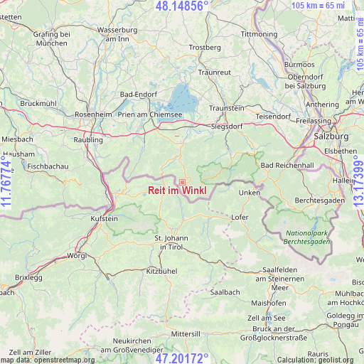
Reit im Winkl GPS coordinates[2]
47° 40' 38.244" North, 12° 28' 15.096" East
| Map corner | latitude | longitude |
|---|---|---|
| Upper-left | 48.14856°, | 11.76774° |
| Center: | 47.67729°, | 12.47086° |
| Lower-right: | 47.20172°, | 13.17399° |
| Map W x H: | 105.3×105.3 km | = 65.4×65.4mi |
| max Lat: | 55.01917° ⇑99% North |
| Reit im Winkl: | 47.67729° |
| min Lat: | ⇓1% South 47.40724° |
| min Long | Reit im Winkl | max Long |
| 5.92978° | 12.47086° | 14.98853° |
| W 87.8%⇐ | ⇒12.2% E |
Elevation
Elevation of Reit im Winkl is 692 m = 2270 ft, and this is 442.9 m = 1453 ft above average elevation for this country.
| Max E: |
1256 m = 4121 ft | 2.4% |
| Reit im Winkl | 692 m 2270 ft | |
| Avg. | 249.1 m = 817 ft | |
Min E: |
-5 m = -16 ft | 97.6% |
See also: Germany elevation on elevation.city.
Geographical zone
Reit im Winkl is located in North temperate zone (between Tropic of Cancer and the Arctic Circle). Distance of this North polar circle is 2100 km =1304.9 mi to North.| Distance of | km | miles | from Reit im Winkl |
|---|---|---|---|
| North Pole | 4705.8 | 2924 | to North |
| Arctic Circle | 2100 | 1304.9 | to North |
| Tropic Cancer | 2695.3 | 1674.8 | to South |
| Equator | 5301.2 | 3294 | to South |


Nearby cities:
15 places around Reit im Winkl: (largest is in red/bold)
• Aschau im Chiemgau
15.7 km =9.8 mi,  315°
315°
• Bergen
17.1 km =10.6 mi,  31°
31°
• Bernau am Chiemsee
16.6 km =10.3 mi,  334°
334°
• Chiemsee
21.4 km =13.3 mi,  349°
349°
• Frasdorf
19.8 km =12.3 mi, 315°
• Grabenstätt
19.5 km =12.1 mi,  16°
16°
• Grassau
11.6 km =7.2 mi, 353°
• Marquartstein
9.1 km =5.7 mi,  355°
355°
• Ruhpolding
16.7 km =10.4 mi,  53°
53°
• Schleching
7.5 km =4.7 mi,  310°
310°
• Siegsdorf
20.7 km =12.9 mi,  38°
38°
• Staudach-Egerndach
11.8 km =7.3 mi,  4°
4°
• Unterwössen
6.2 km =3.9 mi, 357°
• Vachendorf
21 km =13 mi, 28°
• Übersee
15.5 km =9.6 mi, 3°
Sources, notices
• [Note1] Compared only with cities in Germany existing in our database
• [Src1] Map data: © OpenStreetMap contributors (CC-BY-SA)
• [Src2] Other city data from geonames.org with taken over terms of usage.
• [Src3] Geographical zone / Annual Mean Temperature by Robert A. Rohde @ Wikipedia
