Aschau im Chiemgau geodata
Aschau im Chiemgau (Bavaria) is a populated place; located in Germany in Europe/Berlin (GMT+2) time zone. With population of 5,410 people, there are 2661 cities with bigger population in this country. Compared to other cities in Germany, 97.9% of cities are located further ↑North; 86% of cities are located further ←West and 95.4% of cities have lower elevation than Aschau im Chiemgau. Note1
Administrative division(s):
- Level 1: Bavaria
- Level 2: Upper Bavaria
- Level 3: Landkreis Rosenheim
- Level 4: Aschau i.Chiemgau


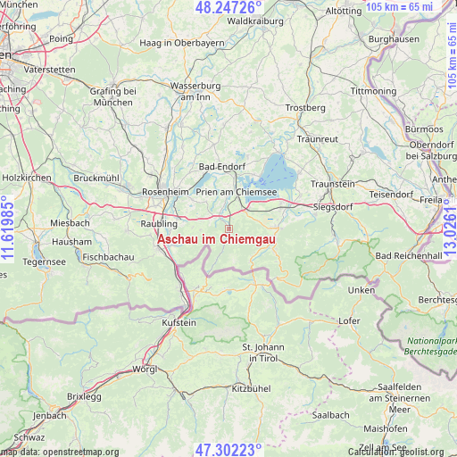
Aschau im Chiemgau GPS coordinates[2]
47° 46' 36.804" North, 12° 19' 22.692" East
| Map corner | latitude | longitude |
|---|---|---|
| Upper-left | 48.24726°, | 11.61985° |
| Center: | 47.77689°, | 12.32297° |
| Lower-right: | 47.30223°, | 13.0261° |
| Map W x H: | 105.1×105.1 km | = 65.3×65.3mi |
| max Lat: | 55.01917° ⇑97.9% North |
| Aschau im Chiemgau: | 47.77689° |
| min Lat: | ⇓2.1% South 47.40724° |
| min Long | Aschau im Chiem | max Long |
| 5.92978° | 12.32297° | 14.98853° |
| W 86%⇐ | ⇒14% E |
Elevation
Elevation of Aschau im Chiemgau is 608 m = 1995 ft, and this is 358.9 m = 1177 ft above average elevation for this country.
| Max E: |
1256 m = 4121 ft | 4.6% |
| Aschau im Chiemgau | 608 m 1995 ft | |
| Avg. | 249.1 m = 817 ft | |
Min E: |
-5 m = -16 ft | 95.4% |
See also: Germany elevation on elevation.city.
Geographical zone
Aschau im Chiemgau is located in North temperate zone (between Tropic of Cancer and the Arctic Circle). Distance of this North polar circle is 2088.9 km =1298 mi to North.| Distance of | km | miles | from Aschau im Chiemgau |
|---|---|---|---|
| North Pole | 4694.8 | 2917.2 | to North |
| Arctic Circle | 2088.9 | 1298 | to North |
| Tropic Cancer | 2706.4 | 1681.7 | to South |
| Equator | 5312.3 | 3300.9 | to South |


Nearby cities:
15 places around Aschau im Chiemgau: (largest is in red/bold)
• Bernau am Chiemsee
5.5 km =3.4 mi,  45°
45°
• Chiemsee
12.2 km =7.6 mi,  35°
35°
• Frasdorf
4.1 km =2.5 mi,  316°
316°
• Grassau
9.8 km =6.1 mi,  87°
87°
• Marquartstein
10.6 km =6.6 mi,  101°
101°
• Nußdorf am Inn
13.1 km =8.1 mi,  252°
252°
• Prien am Chiemsee
9 km =5.6 mi,  11°
11°
• Riedering
11 km =6.8 mi,  308°
308°
• Rimsting
11.6 km =7.2 mi, 5°
• Rohrdorf
11.6 km =7.2 mi,  281°
281°
• Samerberg
9.8 km =6.1 mi,  269°
269°
• Schleching
8.2 km =5.1 mi,  139°
139°
• Staudach-Egerndach
12 km =7.5 mi, 86°
• Unterwössen
11.8 km =7.3 mi,  114°
114°
• Übersee
12.8 km =8 mi,  69°
69°
Sources, notices
• [Note1] Compared only with cities in Germany existing in our database
• [Src1] Map data: © OpenStreetMap contributors (CC-BY-SA)
• [Src2] Other city data from geonames.org with taken over terms of usage.
• [Src3] Geographical zone / Annual Mean Temperature by Robert A. Rohde @ Wikipedia
