Marl geodata
Marl (North Rhine-Westphalia) is a populated place; located in Germany in Europe/Berlin (GMT+2) time zone. With population of 91,398 people, there are 108 cities with bigger population in this country. Compared to other cities in Germany, 68.4% of cities are located further ↓South; 92.4% of cities are located further →East and 77% of cities have higher elevation than Marl. Note1
Administrative division(s):
- Level 1: North Rhine-Westphalia
- Level 2: Regierungsbezirk Münster
- Level 3: Kreis Recklinghausen
- Level 4: Marl


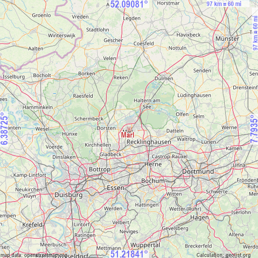
Marl GPS coordinates[2]
51° 39' 24.156" North, 7° 5' 25.368" East
| Map corner | latitude | longitude |
|---|---|---|
| Upper-left | 52.09081°, | 6.38725° |
| Center: | 51.65671°, | 7.09038° |
| Lower-right: | 51.21841°, | 7.7935° |
| Map W x H: | 97×97 km | = 60.3×60.3mi |
| max Lat: | 55.01917° ⇑31.6% North |
| Marl: | 51.65671° |
| min Lat: | ⇓68.4% South 47.40724° |
| min Long | Marl | max Long |
| 5.92978° | 7.09038° | 14.98853° |
| W 7.6%⇐ | ⇒92.4% E |
Elevation
Elevation of Marl is 56 m = 184 ft, and this is 193.1 m = 634 ft below average elevation for this country.
| Max E: |
1256 m = 4121 ft | 77% |
| Avg. | 249.1 m = 817 ft | |
| Marl | 56 m = 184 ft | |
Min E: |
-5 m = -16 ft | 23% |
See also: Marl elevation on elevation.city.
Geographical zone
Marl is located in North temperate zone (between Tropic of Cancer and the Arctic Circle). Distance of this North polar circle is 1657.5 km =1029.9 mi to North.| Distance of | km | miles | from Marl |
|---|---|---|---|
| North Pole | 4263.4 | 2649.2 | to North |
| Arctic Circle | 1657.5 | 1029.9 | to North |
| Tropic Cancer | 3137.8 | 1949.7 | to South |
| Equator | 5743.7 | 3569 | to South |


Nearby cities:
15 places around Marl: (largest is in red/bold)
• Bochum-Hordel
18.2 km =11.3 mi,  161°
161°
• Bottrop
18.5 km =11.5 mi,  217°
217°
• Castrop-Rauxel
18.9 km =11.7 mi,  126°
126°
• Datteln
17.6 km =10.9 mi,  90°
90°
• Dorsten
8.7 km =5.4 mi,  273°
273°
• Gelsenkirchen
16.9 km =10.5 mi,  178°
178°
• Gladbeck
12 km =7.5 mi, 217°
• Haltern am See
11.5 km =7.1 mi,  33°
33°
• Herne
16.1 km =10 mi,  144°
144°
• Herten
7.7 km =4.8 mi,  151°
151°
• Hordel
18.6 km =11.6 mi, 161°
• Klein Reken
14.9 km =9.3 mi,  347°
347°
• Oer-Erkenschwick
12.1 km =7.5 mi,  97°
97°
• Recklinghausen
8.8 km =5.5 mi,  122°
122°
• Schermbeck
15.7 km =9.8 mi,  280°
280°
Sources, notices
• [Note1] Compared only with cities in Germany existing in our database
• [Src1] Map data: © OpenStreetMap contributors (CC-BY-SA)
• [Src2] Other city data from geonames.org with taken over terms of usage.
• [Src3] Geographical zone / Annual Mean Temperature by Robert A. Rohde @ Wikipedia
