Herten geodata
Herten (North Rhine-Westphalia) is a populated place; located in Germany in Europe/Berlin (GMT+2) time zone. With population of 65,306 people, there are 158 cities with bigger population in this country. Compared to other cities in Germany, 67.6% of cities are located further ↓South; 91.9% of cities are located further →East and 73.8% of cities have higher elevation than Herten. Note1
Administrative division(s):
- Level 1: North Rhine-Westphalia
- Level 2: Regierungsbezirk Münster
- Level 3: Kreis Recklinghausen
- Level 4: Herten


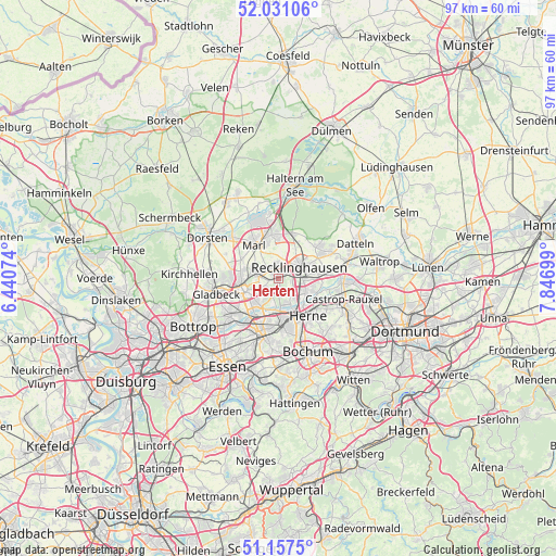
Herten GPS coordinates[2]
51° 35' 46.968" North, 7° 8' 37.932" East
| Map corner | latitude | longitude |
|---|---|---|
| Upper-left | 52.03106°, | 6.44074° |
| Center: | 51.59638°, | 7.14387° |
| Lower-right: | 51.1575°, | 7.84699° |
| Map W x H: | 97.1×97.1 km | = 60.3×60.3mi |
| max Lat: | 55.01917° ⇑32.4% North |
| Herten: | 51.59638° |
| min Lat: | ⇓67.6% South 47.40724° |
| min Long | Herten | max Long |
| 5.92978° | 7.14387° | 14.98853° |
| W 8.1%⇐ | ⇒91.9% E |
Elevation
Elevation of Herten is 68 m = 223 ft, and this is 181.1 m = 594 ft below average elevation for this country.
| Max E: |
1256 m = 4121 ft | 73.8% |
| Avg. | 249.1 m = 817 ft | |
| Herten | 68 m = 223 ft | |
Min E: |
-5 m = -16 ft | 26.2% |
See also: Herten elevation on elevation.city.
Geographical zone
Herten is located in North temperate zone (between Tropic of Cancer and the Arctic Circle). Distance of this North polar circle is 1664.2 km =1034.1 mi to North.| Distance of | km | miles | from Herten |
|---|---|---|---|
| North Pole | 4270.1 | 2653.3 | to North |
| Arctic Circle | 1664.2 | 1034.1 | to North |
| Tropic Cancer | 3131.1 | 1945.6 | to South |
| Equator | 5737 | 3564.8 | to South |


Nearby cities:
15 places around Herten: (largest is in red/bold)
• Bochum
13.7 km =8.5 mi,  158°
158°
• Bochum-Hordel
10.8 km =6.7 mi,  168°
168°
• Bottrop
16.9 km =10.5 mi,  241°
241°
• Castrop-Rauxel
12.4 km =7.7 mi,  110°
110°
• Datteln
15.4 km =9.6 mi,  64°
64°
• Dorsten
14.3 km =8.9 mi,  300°
300°
• Essen
18 km =11.2 mi,  210°
210°
• Gelsenkirchen
10.7 km =6.6 mi,  197°
197°
• Gladbeck
11.3 km =7 mi,  255°
255°
• Haltern am See
16.5 km =10.3 mi,  9°
9°
• Herne
8.5 km =5.3 mi,  138°
138°
• Hordel
11.2 km =7 mi, 168°
• Marl
7.7 km =4.8 mi,  331°
331°
• Oer-Erkenschwick
9.8 km =6.1 mi, 58°
• Recklinghausen
4.2 km =2.6 mi, 62°
Sources, notices
• [Note1] Compared only with cities in Germany existing in our database
• [Src1] Map data: © OpenStreetMap contributors (CC-BY-SA)
• [Src2] Other city data from geonames.org with taken over terms of usage.
• [Src3] Geographical zone / Annual Mean Temperature by Robert A. Rohde @ Wikipedia
