Brand-Erbisdorf geodata
Brand-Erbisdorf (Saxony) is a populated place; located in Germany in Europe/Berlin (GMT+2) time zone. With population of 11,284 people, there are 1466 cities with bigger population in this country. Compared to other cities in Germany, 55.4% of cities are located further ↓South; 94.5% of cities are located further ←West and 84.9% of cities have lower elevation than Brand-Erbisdorf. Note1
Administrative division(s):
- Level 1: Saxony
- Level 3: Landkreis Mittelsachsen
- Level 4: Brand-Erbisdorf


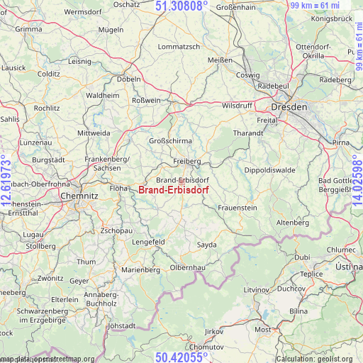
Brand-Erbisdorf GPS coordinates[2]
50° 51' 59.148" North, 13° 19' 22.26" East
| Map corner | latitude | longitude |
|---|---|---|
| Upper-left | 51.30808°, | 12.61973° |
| Center: | 50.86643°, | 13.32285° |
| Lower-right: | 50.42055°, | 14.02598° |
| Map W x H: | 98.7×98.7 km | = 61.3×61.3mi |
| max Lat: | 55.01917° ⇑44.6% North |
| Brand-Erbisdorf: | 50.86643° |
| min Lat: | ⇓55.4% South 47.40724° |
| min Long | Brand-Erbisdorf | max Long |
| 5.92978° | 13.32285° | 14.98853° |
| W 94.5%⇐ | ⇒5.5% E |
Elevation
Elevation of Brand-Erbisdorf is 468 m = 1535 ft, and this is 218.9 m = 718 ft above average elevation for this country.
| Max E: |
1256 m = 4121 ft | 15.1% |
| Brand-Erbisdorf | 468 m 1535 ft | |
| Avg. | 249.1 m = 817 ft | |
Min E: |
-5 m = -16 ft | 84.9% |
See also: Germany elevation on elevation.city.
Geographical zone
Brand-Erbisdorf is located in North temperate zone (between Tropic of Cancer and the Arctic Circle). Distance of this North polar circle is 1745.4 km =1084.5 mi to North.| Distance of | km | miles | from Brand-Erbisdorf |
|---|---|---|---|
| North Pole | 4351.2 | 2703.7 | to North |
| Arctic Circle | 1745.4 | 1084.5 | to North |
| Tropic Cancer | 3049.9 | 1895.1 | to South |
| Equator | 5655.8 | 3514.4 | to South |


Nearby cities:
15 places around Brand-Erbisdorf: (largest is in red/bold)
• Dorfchemnitz
14.2 km =8.8 mi,  141°
141°
• Eppendorf
9.7 km =6 mi,  220°
220°
• Frankenstein
8.8 km =5.5 mi,  295°
295°
• Freiberg
5.1 km =3.2 mi,  12°
12°
• Gahlenz
9.1 km =5.7 mi,  239°
239°
• Großhartmannsdorf
7.4 km =4.6 mi,  174°
174°
• Großschirma
11.4 km =7.1 mi,  346°
346°
• Halsbrücke
9.5 km =5.9 mi, 11°
• Leubsdorf
13.2 km =8.2 mi, 236°
• Lichtenberg
8 km =5 mi,  116°
116°
• Mulda
9.2 km =5.7 mi, 135°
• Niederschöna
13 km =8.1 mi,  31°
31°
• Oberschöna
6 km =3.7 mi,  305°
305°
• Oederan
10.6 km =6.6 mi,  266°
266°
• Pretzschendorf
14.2 km =8.8 mi,  86°
86°
Sources, notices
• [Note1] Compared only with cities in Germany existing in our database
• [Src1] Map data: © OpenStreetMap contributors (CC-BY-SA)
• [Src2] Other city data from geonames.org with taken over terms of usage.
• [Src3] Geographical zone / Annual Mean Temperature by Robert A. Rohde @ Wikipedia
