Leißling geodata
Leißling (Saxony-Anhalt) is a populated place; located in Germany in Europe/Berlin (GMT+2) time zone. With population of 1,541 people, there are 5793 cities with bigger population in this country. Compared to other cities in Germany, 61.2% of cities are located further ↓South; 80.4% of cities are located further ←West and 67.8% of cities have higher elevation than Leißling. Note1


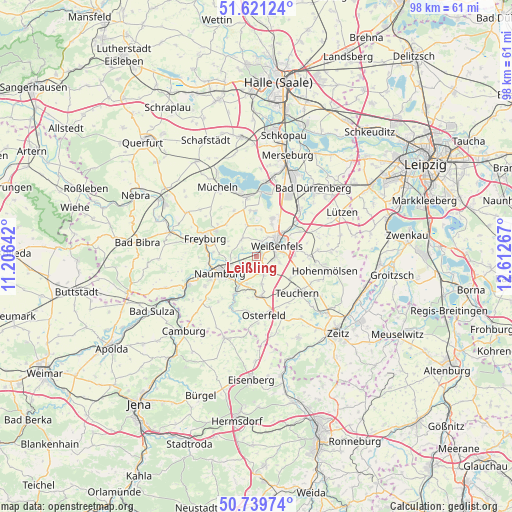
Leißling GPS coordinates[2]
51° 10' 57.36" North, 11° 54' 34.344" East
| Map corner | latitude | longitude |
|---|---|---|
| Upper-left | 51.62124°, | 11.20642° |
| Center: | 51.1826°, | 11.90954° |
| Lower-right: | 50.73974°, | 12.61267° |
| Map W x H: | 98×98 km | = 60.9×60.9mi |
| max Lat: | 55.01917° ⇑38.8% North |
| Leißling: | 51.1826° |
| min Lat: | ⇓61.2% South 47.40724° |
| min Long | Leißling | max Long |
| 5.92978° | 11.90954° | 14.98853° |
| W 80.4%⇐ | ⇒19.6% E |
Elevation
Elevation of Leißling is 103 m = 338 ft, and this is 146.1 m = 479 ft below average elevation for this country.
| Max E: |
1256 m = 4121 ft | 67.8% |
| Avg. | 249.1 m = 817 ft | |
| Leißling | 103 m = 338 ft | |
Min E: |
-5 m = -16 ft | 32.2% |
See also: Germany elevation on elevation.city.
Geographical zone
Leißling is located in North temperate zone (between Tropic of Cancer and the Arctic Circle). Distance of this North polar circle is 1710.2 km =1062.7 mi to North.| Distance of | km | miles | from Leißling |
|---|---|---|---|
| North Pole | 4316.1 | 2681.9 | to North |
| Arctic Circle | 1710.2 | 1062.7 | to North |
| Tropic Cancer | 3085.1 | 1917 | to South |
| Equator | 5691 | 3536.2 | to South |


Nearby cities:
15 places around Leißling: (largest is in red/bold)
• Burgwerben
6.8 km =4.2 mi,  49°
49°
• Goseck
3.6 km =2.2 mi,  302°
302°
• Gröbitz
5.4 km =3.4 mi,  168°
168°
• Langendorf
3.6 km =2.2 mi,  95°
95°
• Markwerben
4.3 km =2.7 mi,  30°
30°
• Naumburg
7.8 km =4.8 mi,  242°
242°
• Prittitz
3.9 km =2.4 mi,  158°
158°
• Reichardtswerben
7.9 km =4.9 mi,  22°
22°
• Schönburg
3.5 km =2.2 mi, 239°
• Storkau
5.1 km =3.2 mi,  11°
11°
• Stößen
7.7 km =4.8 mi, 172°
• Tagewerben
6.8 km =4.2 mi, 25°
• Uichteritz
2.8 km =1.7 mi, 18°
• Weißenfels
4.6 km =2.9 mi,  62°
62°
• Wethau
6.2 km =3.9 mi,  216°
216°
Sources, notices
• [Note1] Compared only with cities in Germany existing in our database
• [Src1] Map data: © OpenStreetMap contributors (CC-BY-SA)
• [Src2] Other city data from geonames.org with taken over terms of usage.
• [Src3] Geographical zone / Annual Mean Temperature by Robert A. Rohde @ Wikipedia
