Langendorf geodata
Langendorf (Saxony-Anhalt) is a populated place; located in Germany in Europe/Berlin (GMT+2) time zone. With population of 2,568 people, there are 4363 cities with bigger population in this country. Compared to other cities in Germany, 61.2% of cities are located further ↓South; 81.3% of cities are located further ←West and 61.3% of cities have higher elevation than Langendorf. Note1


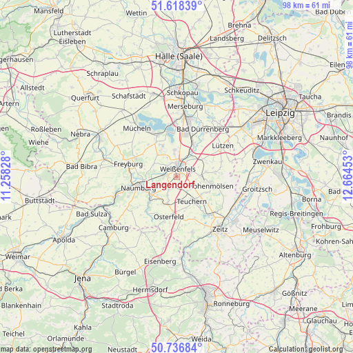
Langendorf GPS coordinates[2]
51° 10' 46.992" North, 11° 57' 41.04" East
| Map corner | latitude | longitude |
|---|---|---|
| Upper-left | 51.61839°, | 11.25828° |
| Center: | 51.17972°, | 11.9614° |
| Lower-right: | 50.73684°, | 12.66453° |
| Map W x H: | 98×98 km | = 60.9×60.9mi |
| max Lat: | 55.01917° ⇑38.8% North |
| Langendorf: | 51.17972° |
| min Lat: | ⇓61.2% South 47.40724° |
| min Long | Langendorf | max Long |
| 5.92978° | 11.9614° | 14.98853° |
| W 81.3%⇐ | ⇒18.7% E |
Elevation
Elevation of Langendorf is 143 m = 469 ft, and this is 106.1 m = 348 ft below average elevation for this country.
| Max E: |
1256 m = 4121 ft | 61.3% |
| Avg. | 249.1 m = 817 ft | |
| Langendorf | 143 m = 469 ft | |
Min E: |
-5 m = -16 ft | 38.7% |
See also: Germany elevation on elevation.city.
Geographical zone
Langendorf is located in North temperate zone (between Tropic of Cancer and the Arctic Circle). Distance of this North polar circle is 1710.5 km =1062.9 mi to North.| Distance of | km | miles | from Langendorf |
|---|---|---|---|
| North Pole | 4316.4 | 2682.1 | to North |
| Arctic Circle | 1710.5 | 1062.9 | to North |
| Tropic Cancer | 3084.7 | 1916.7 | to South |
| Equator | 5690.7 | 3536 | to South |


Nearby cities:
15 places around Langendorf: (largest is in red/bold)
• Burgwerben
5 km =3.1 mi,  18°
18°
• Goseck
7 km =4.3 mi,  288°
288°
• Granschütz
6.3 km =3.9 mi,  85°
85°
• Gröbitz
5.6 km =3.5 mi,  207°
207°
• Krauschwitz
6.8 km =4.2 mi,  173°
173°
• Leißling
3.6 km =2.2 mi,  275°
275°
• Markwerben
4.3 km =2.7 mi,  340°
340°
• Nessa
5 km =3.1 mi,  138°
138°
• Prittitz
4 km =2.5 mi, 213°
• Schönburg
6.8 km =4.2 mi,  257°
257°
• Storkau
5.9 km =3.7 mi,  334°
334°
• Tagewerben
6.5 km =4 mi,  353°
353°
• Uichteritz
4 km =2.5 mi,  317°
317°
• Weißenfels
2.5 km =1.6 mi,  11°
11°
• Zorbau
4.5 km =2.8 mi,  72°
72°
Sources, notices
• [Note1] Compared only with cities in Germany existing in our database
• [Src1] Map data: © OpenStreetMap contributors (CC-BY-SA)
• [Src2] Other city data from geonames.org with taken over terms of usage.
• [Src3] Geographical zone / Annual Mean Temperature by Robert A. Rohde @ Wikipedia
