Schechingen geodata
Schechingen (Baden-Württemberg) is a seat of a fourth-order administrative division; located in Germany in Europe/Berlin (GMT+2) time zone. With population of 2,484 people, there are 4459 cities with bigger population in this country. Compared to other cities in Germany, 84.4% of cities are located further ↑North; 51.2% of cities are located further →East and 86.8% of cities have lower elevation than Schechingen. Note1
Administrative division(s):
- Level 1: Baden-Württemberg
- Level 2: Regierungsbezirk Stuttgart
- Level 3: Ostalbkreis
- Level 4: Schechingen


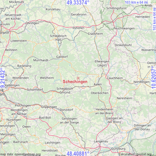
Schechingen GPS coordinates[2]
48° 52' 24.276" North, 9° 55' 2.784" East
| Map corner | latitude | longitude |
|---|---|---|
| Upper-left | 49.33374°, | 9.21432° |
| Center: | 48.87341°, | 9.91744° |
| Lower-right: | 48.40881°, | 10.62057° |
| Map W x H: | 102.8×102.8 km | = 63.9×63.9mi |
| max Lat: | 55.01917° ⇑84.4% North |
| Schechingen: | 48.87341° |
| min Lat: | ⇓15.6% South 47.40724° |
| min Long | Schechingen | max Long |
| 5.92978° | 9.91744° | 14.98853° |
| W 48.8%⇐ | ⇒51.2% E |
Elevation
Elevation of Schechingen is 484 m = 1588 ft, and this is 234.9 m = 771 ft above average elevation for this country.
| Max E: |
1256 m = 4121 ft | 13.2% |
| Schechingen | 484 m 1588 ft | |
| Avg. | 249.1 m = 817 ft | |
Min E: |
-5 m = -16 ft | 86.8% |
See also: Germany elevation on elevation.city.
Geographical zone
Schechingen is located in North temperate zone (between Tropic of Cancer and the Arctic Circle). Distance of this North polar circle is 1967 km =1222.2 mi to North.| Distance of | km | miles | from Schechingen |
|---|---|---|---|
| North Pole | 4572.8 | 2841.4 | to North |
| Arctic Circle | 1967 | 1222.2 | to North |
| Tropic Cancer | 2828.3 | 1757.4 | to South |
| Equator | 5434.2 | 3376.7 | to South |


Nearby cities:
15 places around Schechingen: (largest is in red/bold)
• Abtsgmünd
6.6 km =4.1 mi,  68°
68°
• Böbingen an der Rems
6 km =3.7 mi,  177°
177°
• Durlangen
9 km =5.6 mi,  257°
257°
• Eschach
3.8 km =2.4 mi,  295°
295°
• Gerabronn
10.8 km =6.7 mi,  0°
0°
• Göggingen
2.8 km =1.7 mi,  241°
241°
• Heubach
9.1 km =5.7 mi,  172°
172°
• Heuchlingen
3.1 km =1.9 mi,  140°
140°
• Iggingen
5.4 km =3.4 mi,  211°
211°
• Leinzell
4 km =2.5 mi,  227°
227°
• Mutlangen
10.3 km =6.4 mi, 239°
• Mögglingen
6.5 km =4 mi,  149°
149°
• Obergröningen
2.4 km =1.5 mi,  345°
345°
• Ruppertshofen
7.6 km =4.7 mi,  277°
277°
• Täferrot
6.4 km =4 mi,  245°
245°
Sources, notices
• [Note1] Compared only with cities in Germany existing in our database
• [Src1] Map data: © OpenStreetMap contributors (CC-BY-SA)
• [Src2] Other city data from geonames.org with taken over terms of usage.
• [Src3] Geographical zone / Annual Mean Temperature by Robert A. Rohde @ Wikipedia
