Laudenbach geodata
Laudenbach (Baden-Württemberg) is a seat of a fourth-order administrative division; located in Germany in Europe/Berlin (GMT+2) time zone. With population of 6,141 people, there are 2417 cities with bigger population in this country. Compared to other cities in Germany, 73.5% of cities are located further ↑North; 69.5% of cities are located further →East and 64.8% of cities have higher elevation than Laudenbach. Note1
Administrative division(s):
- Level 1: Baden-Württemberg
- Level 2: Karlsruhe Region
- Level 3: Rhein-Neckar-Kreis
- Level 4: Laudenbach


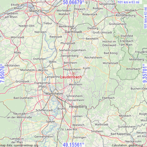
Laudenbach GPS coordinates[2]
49° 36' 47.988" North, 8° 39' 14.004" East
| Map corner | latitude | longitude |
|---|---|---|
| Upper-left | 50.06679°, | 7.95076° |
| Center: | 49.61333°, | 8.65389° |
| Lower-right: | 49.15561°, | 9.35701° |
| Map W x H: | 101.3×101.3 km | = 62.9×62.9mi |
| max Lat: | 55.01917° ⇑73.5% North |
| Laudenbach: | 49.61333° |
| min Lat: | ⇓26.5% South 47.40724° |
| min Long | Laudenbach | max Long |
| 5.92978° | 8.65389° | 14.98853° |
| W 30.5%⇐ | ⇒69.5% E |
Elevation
Elevation of Laudenbach is 121 m = 397 ft, and this is 128.1 m = 420 ft below average elevation for this country.
| Max E: |
1256 m = 4121 ft | 64.8% |
| Avg. | 249.1 m = 817 ft | |
| Laudenbach | 121 m = 397 ft | |
Min E: |
-5 m = -16 ft | 35.2% |
See also: Germany elevation on elevation.city.
Geographical zone
Laudenbach is located in North temperate zone (between Tropic of Cancer and the Arctic Circle). Distance of this North polar circle is 1884.7 km =1171.1 mi to North.| Distance of | km | miles | from Laudenbach |
|---|---|---|---|
| North Pole | 4490.6 | 2790.3 | to North |
| Arctic Circle | 1884.7 | 1171.1 | to North |
| Tropic Cancer | 2910.6 | 1808.6 | to South |
| Equator | 5516.5 | 3427.8 | to South |


Nearby cities:
15 places around Laudenbach: (largest is in red/bold)
• Bensheim
8.2 km =5.1 mi,  341°
341°
• Birkenau
6.8 km =4.2 mi,  145°
145°
• Einhausen
10.4 km =6.5 mi,  312°
312°
• Fürth
10.3 km =6.4 mi,  66°
66°
• Heddesheim
12.5 km =7.8 mi,  196°
196°
• Hemsbach
2.5 km =1.6 mi,  189°
189°
• Heppenheim an der Bergstrasse
3.5 km =2.2 mi,  333°
333°
• Hirschberg an der Bergstraße
11.8 km =7.3 mi,  178°
178°
• Lindenfels
12.1 km =7.5 mi,  49°
49°
• Lorsch
7.5 km =4.7 mi,  302°
302°
• Mörlenbach
6 km =3.7 mi,  105°
105°
• Rimbach
8 km =5 mi,  80°
80°
• Viernheim
9.8 km =6.1 mi,  213°
213°
• Weinheim
7.2 km =4.5 mi,  172°
172°
• Zwingenberg
12.7 km =7.9 mi,  345°
345°
Sources, notices
• [Note1] Compared only with cities in Germany existing in our database
• [Src1] Map data: © OpenStreetMap contributors (CC-BY-SA)
• [Src2] Other city data from geonames.org with taken over terms of usage.
• [Src3] Geographical zone / Annual Mean Temperature by Robert A. Rohde @ Wikipedia
