Langenpreising geodata
Langenpreising (Bavaria) is a seat of a fourth-order administrative division; located in Germany in Europe/Berlin (GMT+2) time zone. With population of 2,496 people, there are 4445 cities with bigger population in this country. Compared to other cities in Germany, 89.9% of cities are located further ↑North; 81.5% of cities are located further ←West and 78.5% of cities have lower elevation than Langenpreising. Note1
Administrative division(s):
- Level 1: Bavaria
- Level 2: Upper Bavaria
- Level 3: Landkreis Erding
- Level 4: Langenpreising


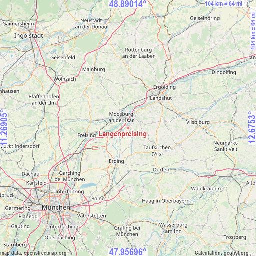
Langenpreising GPS coordinates[2]
48° 25' 32.484" North, 11° 58' 19.812" East
| Map corner | latitude | longitude |
|---|---|---|
| Upper-left | 48.89014°, | 11.26905° |
| Center: | 48.42569°, | 11.97217° |
| Lower-right: | 47.95696°, | 12.6753° |
| Map W x H: | 103.8×103.8 km | = 64.5×64.5mi |
| max Lat: | 55.01917° ⇑89.9% North |
| Langenpreising: | 48.42569° |
| min Lat: | ⇓10.1% South 47.40724° |
| min Long | Langenpreising | max Long |
| 5.92978° | 11.97217° | 14.98853° |
| W 81.5%⇐ | ⇒18.5% E |
Elevation
Elevation of Langenpreising is 423 m = 1388 ft, and this is 173.9 m = 571 ft above average elevation for this country.
| Max E: |
1256 m = 4121 ft | 21.5% |
| Langenpreising | 423 m 1388 ft | |
| Avg. | 249.1 m = 817 ft | |
Min E: |
-5 m = -16 ft | 78.5% |
See also: Germany elevation on elevation.city.
Geographical zone
Langenpreising is located in North temperate zone (between Tropic of Cancer and the Arctic Circle). Distance of this North polar circle is 2016.7 km =1253.1 mi to North.| Distance of | km | miles | from Langenpreising |
|---|---|---|---|
| North Pole | 4622.6 | 2872.3 | to North |
| Arctic Circle | 2016.7 | 1253.1 | to North |
| Tropic Cancer | 2778.5 | 1726.5 | to South |
| Equator | 5384.4 | 3345.7 | to South |


Nearby cities:
15 places around Langenpreising: (largest is in red/bold)
• Berglern
5.6 km =3.5 mi,  213°
213°
• Bruckberg
10.9 km =6.8 mi,  8°
8°
• Eching
10.8 km =6.7 mi,  40°
40°
• Eitting
9.5 km =5.9 mi,  219°
219°
• Fraunberg
6.9 km =4.3 mi,  162°
162°
• Haag an der Amper
11.2 km =7 mi,  288°
288°
• Inning am Holz
11.6 km =7.2 mi,  139°
139°
• Kirchberg
6.4 km =4 mi,  116°
116°
• Langenbach
9.1 km =5.7 mi,  275°
275°
• Mauern
11.4 km =7.1 mi,  332°
332°
• Moosburg
5.6 km =3.5 mi, 333°
• Steinkirchen
9.5 km =5.9 mi, 119°
• Vilsheim
10.3 km =6.4 mi,  75°
75°
• Wang
8.2 km =5.1 mi,  341°
341°
• Wartenberg
2.5 km =1.6 mi,  150°
150°
Sources, notices
• [Note1] Compared only with cities in Germany existing in our database
• [Src1] Map data: © OpenStreetMap contributors (CC-BY-SA)
• [Src2] Other city data from geonames.org with taken over terms of usage.
• [Src3] Geographical zone / Annual Mean Temperature by Robert A. Rohde @ Wikipedia
