Eitting geodata
Eitting (Bavaria) is a seat of a fourth-order administrative division; located in Germany in Europe/Berlin (GMT+2) time zone. With population of 2,238 people, there are 4764 cities with bigger population in this country. Compared to other cities in Germany, 90.6% of cities are located further ↑North; 80.2% of cities are located further ←West and 82% of cities have lower elevation than Eitting. Note1
Administrative division(s):
- Level 1: Bavaria
- Level 2: Upper Bavaria
- Level 3: Landkreis Erding
- Level 4: Eitting


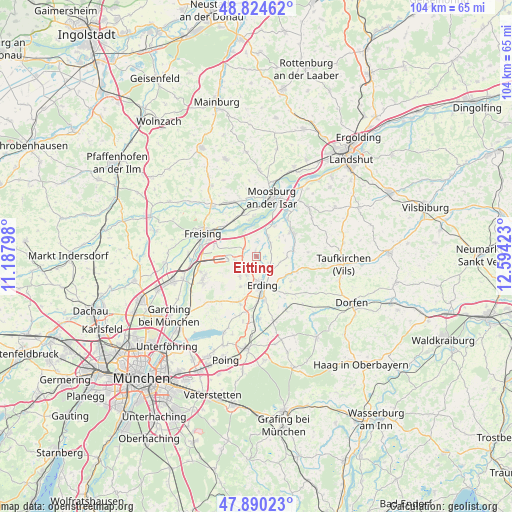
Eitting GPS coordinates[2]
48° 21' 34.452" North, 11° 53' 27.96" East
| Map corner | latitude | longitude |
|---|---|---|
| Upper-left | 48.82462°, | 11.18798° |
| Center: | 48.35957°, | 11.8911° |
| Lower-right: | 47.89023°, | 12.59423° |
| Map W x H: | 103.9×103.9 km | = 64.6×64.6mi |
| max Lat: | 55.01917° ⇑90.6% North |
| Eitting: | 48.35957° |
| min Lat: | ⇓9.4% South 47.40724° |
| min Long | Eitting | max Long |
| 5.92978° | 11.8911° | 14.98853° |
| W 80.2%⇐ | ⇒19.8% E |
Elevation
Elevation of Eitting is 446 m = 1463 ft, and this is 196.9 m = 646 ft above average elevation for this country.
| Max E: |
1256 m = 4121 ft | 18% |
| Eitting | 446 m 1463 ft | |
| Avg. | 249.1 m = 817 ft | |
Min E: |
-5 m = -16 ft | 82% |
See also: Germany elevation on elevation.city.
Geographical zone
Eitting is located in North temperate zone (between Tropic of Cancer and the Arctic Circle). Distance of this North polar circle is 2024.1 km =1257.7 mi to North.| Distance of | km | miles | from Eitting |
|---|---|---|---|
| North Pole | 4630 | 2876.9 | to North |
| Arctic Circle | 2024.1 | 1257.7 | to North |
| Tropic Cancer | 2771.2 | 1721.9 | to South |
| Equator | 5377.1 | 3341.2 | to South |


Nearby cities:
15 places around Eitting: (largest is in red/bold)
• Berglern
4 km =2.5 mi,  46°
46°
• Bockhorn
8.7 km =5.4 mi,  125°
125°
• Eichenried
12.2 km =7.6 mi,  221°
221°
• Erding
6.1 km =3.8 mi,  168°
168°
• Fraunberg
8.1 km =5 mi,  84°
84°
• Freising
11.6 km =7.2 mi,  294°
294°
• Haag an der Amper
11.9 km =7.4 mi,  337°
337°
• Hallbergmoos
10.9 km =6.8 mi,  250°
250°
• Langenbach
8.7 km =5.4 mi, 339°
• Langenpreising
9.5 km =5.9 mi,  39°
39°
• Marzling
9 km =5.6 mi,  307°
307°
• Moosinning
9.8 km =6.1 mi,  200°
200°
• Oberding
5.7 km =3.5 mi,  212°
212°
• Stammham
7.2 km =4.5 mi,  192°
192°
• Wartenberg
8.9 km =5.5 mi, 54°
Sources, notices
• [Note1] Compared only with cities in Germany existing in our database
• [Src1] Map data: © OpenStreetMap contributors (CC-BY-SA)
• [Src2] Other city data from geonames.org with taken over terms of usage.
• [Src3] Geographical zone / Annual Mean Temperature by Robert A. Rohde @ Wikipedia
