Berglern geodata
Berglern (Bavaria) is a seat of a fourth-order administrative division; located in Germany in Europe/Berlin (GMT+2) time zone. With population of 2,423 people, there are 4532 cities with bigger population in this country. Compared to other cities in Germany, 90.4% of cities are located further ↑North; 80.7% of cities are located further ←West and 80.5% of cities have lower elevation than Berglern. Note1
Administrative division(s):
- Level 1: Bavaria
- Level 2: Upper Bavaria
- Level 3: Landkreis Erding
- Level 4: Berglern


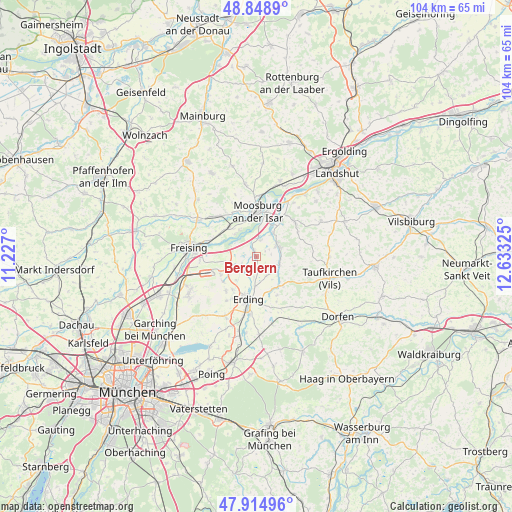
Berglern GPS coordinates[2]
48° 23' 2.652" North, 11° 55' 48.432" East
| Map corner | latitude | longitude |
|---|---|---|
| Upper-left | 48.8489°, | 11.227° |
| Center: | 48.38407°, | 11.93012° |
| Lower-right: | 47.91496°, | 12.63325° |
| Map W x H: | 103.8×103.8 km | = 64.5×64.5mi |
| max Lat: | 55.01917° ⇑90.4% North |
| Berglern: | 48.38407° |
| min Lat: | ⇓9.6% South 47.40724° |
| min Long | Berglern | max Long |
| 5.92978° | 11.93012° | 14.98853° |
| W 80.7%⇐ | ⇒19.3% E |
Elevation
Elevation of Berglern is 436 m = 1430 ft, and this is 186.9 m = 613 ft above average elevation for this country.
| Max E: |
1256 m = 4121 ft | 19.5% |
| Berglern | 436 m 1430 ft | |
| Avg. | 249.1 m = 817 ft | |
Min E: |
-5 m = -16 ft | 80.5% |
See also: Germany elevation on elevation.city.
Geographical zone
Berglern is located in North temperate zone (between Tropic of Cancer and the Arctic Circle). Distance of this North polar circle is 2021.4 km =1256 mi to North.| Distance of | km | miles | from Berglern |
|---|---|---|---|
| North Pole | 4627.3 | 2875.3 | to North |
| Arctic Circle | 2021.4 | 1256 | to North |
| Tropic Cancer | 2773.9 | 1723.6 | to South |
| Equator | 5379.8 | 3342.9 | to South |


Nearby cities:
15 places around Berglern: (largest is in red/bold)
• Bockhorn
8.8 km =5.5 mi,  151°
151°
• Eitting
4 km =2.5 mi,  226°
226°
• Erding
8.8 km =5.5 mi,  191°
191°
• Fraunberg
5.5 km =3.4 mi,  110°
110°
• Haag an der Amper
11.2 km =7 mi,  317°
317°
• Inning am Holz
11.5 km =7.1 mi, 111°
• Kirchberg
9 km =5.6 mi,  78°
78°
• Langenbach
8.1 km =5 mi,  312°
312°
• Langenpreising
5.6 km =3.5 mi,  33°
33°
• Marzling
10.4 km =6.5 mi,  285°
285°
• Moosburg
9.7 km =6 mi,  3°
3°
• Oberding
9.6 km =6 mi,  218°
218°
• Stammham
10.8 km =6.7 mi,  204°
204°
• Steinkirchen
11.3 km =7 mi,  90°
90°
• Wartenberg
5 km =3.1 mi,  60°
60°
Sources, notices
• [Note1] Compared only with cities in Germany existing in our database
• [Src1] Map data: © OpenStreetMap contributors (CC-BY-SA)
• [Src2] Other city data from geonames.org with taken over terms of usage.
• [Src3] Geographical zone / Annual Mean Temperature by Robert A. Rohde @ Wikipedia
