Landstuhl geodata
Landstuhl (Rheinland-Pfalz) is a populated place; located in Germany in Europe/Berlin (GMT+2) time zone. With population of 8,989 people, there are 1793 cities with bigger population in this country. Compared to other cities in Germany, 77% of cities are located further ↑North; 85.5% of cities are located further →East and 53.6% of cities have lower elevation than Landstuhl. Note1
Administrative division(s):
- Level 1: Rheinland-Pfalz
- Level 3: Landkreis Kaiserslautern
- Level 4: Landstuhl, Sickingenstadt


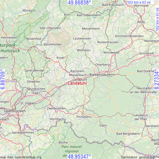
Landstuhl GPS coordinates[2]
49° 24' 47.016" North, 7° 34' 12.756" East
| Map corner | latitude | longitude |
|---|---|---|
| Upper-left | 49.86838°, | 6.86709° |
| Center: | 49.41306°, | 7.57021° |
| Lower-right: | 48.95347°, | 8.27334° |
| Map W x H: | 101.7×101.7 km | = 63.2×63.2mi |
| max Lat: | 55.01917° ⇑77% North |
| Landstuhl: | 49.41306° |
| min Lat: | ⇓23% South 47.40724° |
| min Long | Landstuhl | max Long |
| 5.92978° | 7.57021° | 14.98853° |
| W 14.5%⇐ | ⇒85.5% E |
Elevation
Elevation of Landstuhl is 250 m = 820 ft, and this is 0.90000000000001 m = 3 ft above average elevation for this country.
| Max E: |
1256 m = 4121 ft | 46.4% |
| Landstuhl | 250 m 820 ft | |
| Avg. | 249.1 m = 817 ft | |
Min E: |
-5 m = -16 ft | 53.6% |
See also: Germany elevation on elevation.city.
Geographical zone
Landstuhl is located in North temperate zone (between Tropic of Cancer and the Arctic Circle). Distance of this North polar circle is 1907 km =1185 mi to North.| Distance of | km | miles | from Landstuhl |
|---|---|---|---|
| North Pole | 4512.8 | 2804.1 | to North |
| Arctic Circle | 1907 | 1185 | to North |
| Tropic Cancer | 2888.3 | 1794.7 | to South |
| Equator | 5494.2 | 3413.9 | to South |


Nearby cities:
15 places around Landstuhl: (largest is in red/bold)
• Bann
4.7 km =2.9 mi,  134°
134°
• Gerhardsbrunn
8 km =5 mi,  208°
208°
• Hauptstuhl
6.5 km =4 mi,  256°
256°
• Hütschenhausen
6.3 km =3.9 mi,  273°
273°
• Kindsbach
3.4 km =2.1 mi,  83°
83°
• Kottweiler-Schwanden
8.3 km =5.2 mi,  341°
341°
• Langwieden
6.1 km =3.8 mi,  236°
236°
• Mackenbach
6 km =3.7 mi,  9°
9°
• Martinshöhe
8.1 km =5 mi,  230°
230°
• Mittelbrunn
5.4 km =3.4 mi,  195°
195°
• Oberarnbach
3.4 km =2.1 mi,  163°
163°
• Obernheim-Kirchenarnbach
7.1 km =4.4 mi,  172°
172°
• Queidersbach
6.9 km =4.3 mi,  138°
138°
• Ramstein-Miesenbach
3.7 km =2.3 mi, 342°
• Steinwenden
5.8 km =3.6 mi,  327°
327°
Sources, notices
• [Note1] Compared only with cities in Germany existing in our database
• [Src1] Map data: © OpenStreetMap contributors (CC-BY-SA)
• [Src2] Other city data from geonames.org with taken over terms of usage.
• [Src3] Geographical zone / Annual Mean Temperature by Robert A. Rohde @ Wikipedia
