Ramstein-Miesenbach geodata
Ramstein-Miesenbach (Rheinland-Pfalz) is a populated place; located in Germany in Europe/Berlin (GMT+2) time zone. With population of 8,078 people, there are 1943 cities with bigger population in this country. Compared to other cities in Germany, 76.6% of cities are located further ↑North; 85.9% of cities are located further →East and 52.3% of cities have lower elevation than Ramstein-Miesenbach. Note1
Administrative division(s):
- Level 1: Rheinland-Pfalz
- Level 3: Landkreis Kaiserslautern
- Level 4: Ramstein-Miesenbach


Ramstein-Miesenbach GPS coordinates[2]
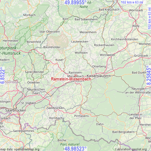
49° 26' 40.272" North, 7° 33' 19.188" East
| Map corner | latitude | longitude |
|---|---|---|
| Upper-left | 49.89955°, | 6.8522° |
| Center: | 49.44452°, | 7.55533° |
| Lower-right: | 48.98523°, | 8.25845° |
| Map W x H: | 101.7×101.7 km | = 63.2×63.2mi |
| max Lat: | 55.01917° ⇑76.6% North |
| Ramstein-Miesenbach: | 49.44452° |
| min Lat: | ⇓23.4% South 47.40724° |
| min Long | Ramstein-Miesen | max Long |
| 5.92978° | 7.55533° | 14.98853° |
| W 14.1%⇐ | ⇒85.9% E |
Elevation
Elevation of Ramstein-Miesenbach is 242 m = 794 ft, and this is 7.1 m = 23 ft below average elevation for this country.
| Max E: |
1256 m = 4121 ft | 47.7% |
| Avg. | 249.1 m = 817 ft | |
| Ramstein-Miesenbach | 242 m = 794 ft | |
Min E: |
-5 m = -16 ft | 52.3% |
See also: Germany elevation on elevation.city.
Geographical zone
Ramstein-Miesenbach is located in North temperate zone (between Tropic of Cancer and the Arctic Circle). Distance of this North polar circle is 1903.5 km =1182.8 mi to North.| Distance of | km | miles | from Ramstein-Miesenbach |
|---|---|---|---|
| North Pole | 4509.3 | 2801.9 | to North |
| Arctic Circle | 1903.5 | 1182.8 | to North |
| Tropic Cancer | 2891.8 | 1796.9 | to South |
| Equator | 5497.7 | 3416.1 | to South |


Nearby cities:
15 places around Ramstein-Miesenbach: (largest is in red/bold)
• Erzenhausen
7.6 km =4.7 mi,  35°
35°
• Hauptstuhl
7.2 km =4.5 mi,  226°
226°
• Hütschenhausen
6.1 km =3.8 mi,  239°
239°
• Kindsbach
5.4 km =3.4 mi,  124°
124°
• Kottweiler-Schwanden
4.6 km =2.9 mi,  339°
339°
• Landstuhl
3.7 km =2.3 mi,  162°
162°
• Langwieden
7.9 km =4.9 mi,  210°
210°
• Mackenbach
3.2 km =2 mi, 39°
• Nanzdietschweiler
7.6 km =4.7 mi,  274°
274°
• Niedermohr
6.4 km =4 mi,  284°
284°
• Oberarnbach
7.1 km =4.4 mi, 163°
• Reichenbach-Steegen
6.2 km =3.9 mi,  356°
356°
• Schwedelbach
6.3 km =3.9 mi,  26°
26°
• Steinwenden
2.5 km =1.6 mi,  304°
304°
• Weilerbach
7.1 km =4.4 mi,  52°
52°
In other languages:
- In Spanish: Ramstein
- In France: Ramstein
- In Russian: Рамштайн-Мизенбах
- In Chinese: 拉姆斯泰因-米森巴
Sources, notices
• [Note1] Compared only with cities in Germany existing in our database
• [Src1] Map data: © OpenStreetMap contributors (CC-BY-SA)
• [Src2] Other city data from geonames.org with taken over terms of usage.
• [Src3] Geographical zone / Annual Mean Temperature by Robert A. Rohde @ Wikipedia
