Kröppelshagen-Fahrendorf geodata
Kröppelshagen-Fahrendorf (Schleswig-Holstein) is a seat of a fourth-order administrative division; located in Germany in Europe/Berlin (GMT+2) time zone. With population of 1,128 people, there are 6770 cities with bigger population in this country. Compared to other cities in Germany, 85.5% of cities are located further ↓South; 55.8% of cities are located further ←West and 76.4% of cities have higher elevation than Kröppelshagen-Fahrendorf. Note1
Administrative division(s):
- Level 1: Schleswig-Holstein
- Level 3: Kreis Herzogtum Lauenburg
- Level 4: Kröppelshagen-Fahrendorf
Current local time in Kröppelshagen-Fahrendorf:
03:56 PM, TuesdayDifference from your time zone: hours


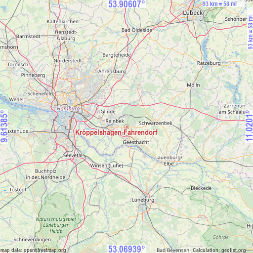
Kröppelshagen-Fahrendorf GPS coordinates[2]
53° 29' 23.244" North, 10° 19' 1.092" East
| Map corner | latitude | longitude |
|---|---|---|
| Upper-left | 53.90607°, | 9.61385° |
| Center: | 53.48979°, | 10.31697° |
| Lower-right: | 53.06939°, | 11.0201° |
| Map W x H: | 93×93 km | = 57.8×57.8mi |
| max Lat: | 55.01917° ⇑14.5% North |
| Kröppelshagen-Fahrendorf: | 53.48979° |
| min Lat: | ⇓85.5% South 47.40724° |
| min Long | Kröppelshagen- | max Long |
| 5.92978° | 10.31697° | 14.98853° |
| W 55.8%⇐ | ⇒44.2% E |
Elevation
Elevation of Kröppelshagen-Fahrendorf is 58 m = 190 ft, and this is 191.1 m = 627 ft below average elevation for this country.
| Max E: |
1256 m = 4121 ft | 76.4% |
| Avg. | 249.1 m = 817 ft | |
| Kröppelshagen-Fahrendorf | 58 m = 190 ft | |
Min E: |
-5 m = -16 ft | 23.6% |
See also: Germany elevation on elevation.city.
Geographical zone
Kröppelshagen-Fahrendorf is located in North temperate zone (between Tropic of Cancer and the Arctic Circle). Distance of this North polar circle is 1453.7 km =903.3 mi to North.| Distance of | km | miles | from Kröppelshagen-Fahrendorf |
|---|---|---|---|
| North Pole | 4059.6 | 2522.5 | to North |
| Arctic Circle | 1453.7 | 903.3 | to North |
| Tropic Cancer | 3341.6 | 2076.4 | to South |
| Equator | 5947.5 | 3695.6 | to South |


Nearby cities:
15 places around Kröppelshagen-Fahrendorf: (largest is in red/bold)
• Bergedorf
5.8 km =3.6 mi,  264°
264°
• Brunstorf
7.2 km =4.5 mi,  86°
86°
• Börnsen
2.8 km =1.7 mi,  237°
237°
• Dassendorf
2.9 km =1.8 mi,  77°
77°
• Drage
8.8 km =5.5 mi,  202°
202°
• Escheburg
2.6 km =1.6 mi,  180°
180°
• Geesthacht
7.2 km =4.5 mi,  146°
146°
• Hamwarde
7.9 km =4.9 mi,  123°
123°
• Hohenhorn
3.5 km =2.2 mi, 115°
• Marschacht
9.1 km =5.7 mi,  155°
155°
• Reinbek
5.4 km =3.4 mi,  303°
303°
• Wentorf bei Hamburg
4.6 km =2.9 mi,  284°
284°
• Witzhave
8.6 km =5.3 mi,  7°
7°
• Wohltorf
3.7 km =2.3 mi,  323°
323°
• Worth
7.1 km =4.4 mi,  111°
111°
Sources, notices
• [Note1] Compared only with cities in Germany existing in our database
• [Src1] Map data: © OpenStreetMap contributors (CC-BY-SA)
• [Src2] Other city data from geonames.org with taken over terms of usage.
• [Src3] Geographical zone / Annual Mean Temperature by Robert A. Rohde @ Wikipedia
