Bergedorf geodata
Bergedorf (Hamburg) is a section of populated place; located in Germany in Europe/Berlin (GMT+2) time zone. With population of 119,665 people, there are 77 cities with bigger population in this country. Compared to other cities in Germany, 85.4% of cities are located further ↓South; 53.9% of cities are located further ←West and 91.6% of cities have higher elevation than Bergedorf. Note1
Administrative division(s):
- Level 1: Hamburg
- Level 3: Hamburg, Freie und Hansestadt
- Level 4: Hamburg, Freie und Hansestadt


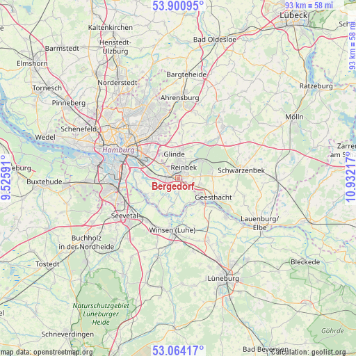
Bergedorf GPS coordinates[2]
53° 29' 4.632" North, 10° 13' 44.544" East
| Map corner | latitude | longitude |
|---|---|---|
| Upper-left | 53.90095°, | 9.52591° |
| Center: | 53.48462°, | 10.22904° |
| Lower-right: | 53.06417°, | 10.93217° |
| Map W x H: | 93×93 km | = 57.8×57.8mi |
| max Lat: | 55.01917° ⇑14.6% North |
| Bergedorf: | 53.48462° |
| min Lat: | ⇓85.4% South 47.40724° |
| min Long | Bergedorf | max Long |
| 5.92978° | 10.22904° | 14.98853° |
| W 53.9%⇐ | ⇒46.1% E |
Elevation
Elevation of Bergedorf is 17 m = 56 ft, and this is 232.1 m = 761 ft below average elevation for this country.
| Max E: |
1256 m = 4121 ft | 91.6% |
| Avg. | 249.1 m = 817 ft | |
| Bergedorf | 17 m = 56 ft | |
Min E: |
-5 m = -16 ft | 8.4% |
See also: Bergedorf elevation on elevation.city.
Geographical zone
Bergedorf is located in North temperate zone (between Tropic of Cancer and the Arctic Circle). Distance of this North polar circle is 1454.2 km =903.6 mi to North.| Distance of | km | miles | from Bergedorf |
|---|---|---|---|
| North Pole | 4060.1 | 2522.8 | to North |
| Arctic Circle | 1454.2 | 903.6 | to North |
| Tropic Cancer | 3341 | 2076 | to South |
| Equator | 5946.9 | 3695.2 | to South |


Nearby cities:
15 places around Bergedorf: (largest is in red/bold)
• Barsbüttel
10 km =6.2 mi,  335°
335°
• Börnsen
3.6 km =2.2 mi,  105°
105°
• Dassendorf
8.7 km =5.4 mi,  82°
82°
• Drage
8 km =5 mi,  161°
161°
• Escheburg
6.1 km =3.8 mi, 108°
• Geesthacht
11.3 km =7 mi,  118°
118°
• Glinde
6.9 km =4.3 mi, 344°
• Hohenhorn
9 km =5.6 mi,  95°
95°
• Kröppelshagen-Fahrendorf
5.8 km =3.6 mi, 84°
• Marschacht
12.4 km =7.7 mi,  128°
128°
• Oststeinbek
7.6 km =4.7 mi,  328°
328°
• Reinbek
3.8 km =2.4 mi,  19°
19°
• Wentorf bei Hamburg
2.2 km =1.4 mi,  39°
39°
• Witzhave
11.4 km =7.1 mi, 37°
• Wohltorf
5.1 km =3.2 mi,  45°
45°
In other languages:
- In France: Arrondissement de Bergedorf
- In German: Bergedorf, Hamburg-Bergedorf, Bezirk Bergedorf
- In Italian: Distretto di Bergedorf
- In Russian: Бергедорф
- In Chinese: 贝格多夫区
Sources, notices
• [Note1] Compared only with cities in Germany existing in our database
• [Src1] Map data: © OpenStreetMap contributors (CC-BY-SA)
• [Src2] Other city data from geonames.org with taken over terms of usage.
• [Src3] Geographical zone / Annual Mean Temperature by Robert A. Rohde @ Wikipedia
