Ilmmünster geodata
Ilmmünster (Bavaria) is a seat of a fourth-order administrative division; located in Germany in Europe/Berlin (GMT+2) time zone. With population of 2,204 people, there are 4800 cities with bigger population in this country. Compared to other cities in Germany, 89.3% of cities are located further ↑North; 74.3% of cities are located further ←West and 85.1% of cities have lower elevation than Ilmmünster. Note1
Administrative division(s):
- Level 1: Bavaria
- Level 2: Upper Bavaria
- Level 3: Landkreis Pfaffenhofen an der Ilm
- Level 4: Ilmmünster


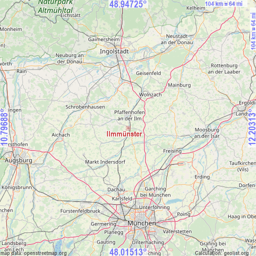
Ilmmünster GPS coordinates[2]
48° 28' 59.988" North, 11° 30' 0" East
| Map corner | latitude | longitude |
|---|---|---|
| Upper-left | 48.94725°, | 10.79688° |
| Center: | 48.48333°, | 11.5° |
| Lower-right: | 48.01513°, | 12.20313° |
| Map W x H: | 103.6×103.6 km | = 64.4×64.4mi |
| max Lat: | 55.01917° ⇑89.3% North |
| Ilmmünster: | 48.48333° |
| min Lat: | ⇓10.7% South 47.40724° |
| min Long | Ilmmünster | max Long |
| 5.92978° | 11.5° | 14.98853° |
| W 74.3%⇐ | ⇒25.7% E |
Elevation
Elevation of Ilmmünster is 470 m = 1542 ft, and this is 220.9 m = 725 ft above average elevation for this country.
| Max E: |
1256 m = 4121 ft | 14.9% |
| Ilmmünster | 470 m 1542 ft | |
| Avg. | 249.1 m = 817 ft | |
Min E: |
-5 m = -16 ft | 85.1% |
See also: Germany elevation on elevation.city.
Geographical zone
Ilmmünster is located in North temperate zone (between Tropic of Cancer and the Arctic Circle). Distance of this North polar circle is 2010.3 km =1249.1 mi to North.| Distance of | km | miles | from Ilmmünster |
|---|---|---|---|
| North Pole | 4616.2 | 2868.4 | to North |
| Arctic Circle | 2010.3 | 1249.1 | to North |
| Tropic Cancer | 2784.9 | 1730.5 | to South |
| Equator | 5390.8 | 3349.7 | to South |


Nearby cities:
15 places around Ilmmünster: (largest is in red/bold)
• Allershausen
9.2 km =5.7 mi,  127°
127°
• Gerolsbach
10.3 km =6.4 mi,  275°
275°
• Hettenshausen
1.9 km =1.2 mi,  0°
0°
• Hilgertshausen-Tandern
12.3 km =7.6 mi,  240°
240°
• Hohenkammer
6.8 km =4.2 mi,  164°
164°
• Jetzendorf
8.3 km =5.2 mi,  227°
227°
• Kirchdorf
11.7 km =7.3 mi,  103°
103°
• Kranzberg
11.9 km =7.4 mi,  135°
135°
• Paunzhausen
4.9 km =3 mi, 101°
• Petershausen
8.5 km =5.3 mi,  194°
194°
• Pfaffenhofen an der Ilm
5.3 km =3.3 mi, 4°
• Reichertshausen
2.2 km =1.4 mi,  146°
146°
• Scheyern
3.1 km =1.9 mi,  307°
307°
• Schweitenkirchen
8 km =5 mi,  73°
73°
• Weichs
12.7 km =7.9 mi,  208°
208°
Sources, notices
• [Note1] Compared only with cities in Germany existing in our database
• [Src1] Map data: © OpenStreetMap contributors (CC-BY-SA)
• [Src2] Other city data from geonames.org with taken over terms of usage.
• [Src3] Geographical zone / Annual Mean Temperature by Robert A. Rohde @ Wikipedia
