Keitum geodata
Keitum (Schleswig-Holstein) is a populated place; located in Germany in Europe/Berlin (GMT+2) time zone. With population of 1,250 people, there are 6446 cities with bigger population in this country. Compared to other cities in Germany, 100% of cities are located further ↓South; 72.2% of cities are located further →East and 94.8% of cities have higher elevation than Keitum. Note1


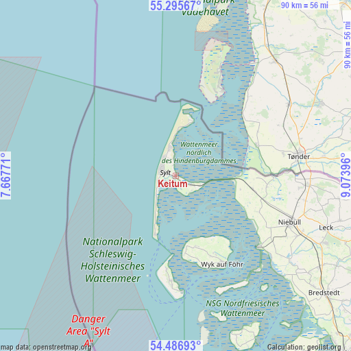
Keitum GPS coordinates[2]
54° 53' 35.988" North, 8° 22' 14.988" East
| Map corner | latitude | longitude |
|---|---|---|
| Upper-left | 55.29567°, | 7.66771° |
| Center: | 54.89333°, | 8.37083° |
| Lower-right: | 54.48693°, | 9.07396° |
| Map W x H: | 89.9×89.9 km | = 55.9×55.9mi |
| max Lat: | 55.01917° ⇑0% North |
| Keitum: | 54.89333° |
| min Lat: | ⇓100% South 47.40724° |
| min Long | Keitum | max Long |
| 5.92978° | 8.37083° | 14.98853° |
| W 27.8%⇐ | ⇒72.2% E |
Elevation
Elevation of Keitum is 9 m = 30 ft, and this is 240.1 m = 788 ft below average elevation for this country.
| Max E: |
1256 m = 4121 ft | 94.8% |
| Avg. | 249.1 m = 817 ft | |
| Keitum | 9 m = 30 ft | |
Min E: |
-5 m = -16 ft | 5.2% |
See also: Germany elevation on elevation.city.
Geographical zone
Keitum is located in North temperate zone (between Tropic of Cancer and the Arctic Circle). Distance of this North polar circle is 1297.6 km =806.3 mi to North.| Distance of | km | miles | from Keitum |
|---|---|---|---|
| North Pole | 3903.5 | 2425.5 | to North |
| Arctic Circle | 1297.6 | 806.3 | to North |
| Tropic Cancer | 3497.6 | 2173.3 | to South |
| Equator | 6103.6 | 3792.6 | to South |


Nearby cities:
15 places around Keitum: (largest is in red/bold)
• Dunsum
18.4 km =11.4 mi,  169°
169°
• Friedrich-Wilhelm-Lübke-Koog
17.1 km =10.6 mi,  100°
100°
• Hörnum
16 km =9.9 mi,  199°
199°
• Kampen
7 km =4.3 mi,  344°
344°
• Klanxbüll
19.9 km =12.4 mi, 99°
• List
14.5 km =9 mi,  15°
15°
• Midlum
22 km =13.7 mi,  154°
154°
• Oldsum
18.7 km =11.6 mi, 165°
• Rantum
7.3 km =4.5 mi,  223°
223°
• Rodenäs
21.1 km =13.1 mi,  93°
93°
• Sylt-Ost
4.4 km =2.7 mi,  144°
144°
• Süderende
19.1 km =11.9 mi, 166°
• Tinnum
2.4 km =1.5 mi,  286°
286°
• Utersum
20 km =12.4 mi, 173°
• Westerland
4.6 km =2.9 mi, 290°
Sources, notices
• [Note1] Compared only with cities in Germany existing in our database
• [Src1] Map data: © OpenStreetMap contributors (CC-BY-SA)
• [Src2] Other city data from geonames.org with taken over terms of usage.
• [Src3] Geographical zone / Annual Mean Temperature by Robert A. Rohde @ Wikipedia
