Kaltenkirchen geodata
Kaltenkirchen (Schleswig-Holstein) is a populated place; located in Germany in Europe/Berlin (GMT+2) time zone. With population of 19,747 people, there are 788 cities with bigger population in this country. Compared to other cities in Germany, 90.4% of cities are located further ↓South; 50.7% of cities are located further →East and 86.3% of cities have higher elevation than Kaltenkirchen. Note1
Administrative division(s):
- Level 1: Schleswig-Holstein
- Level 3: Kreis Segeberg
- Level 4: Kaltenkirchen


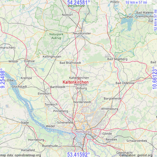
Kaltenkirchen GPS coordinates[2]
53° 49' 58.512" North, 9° 57' 29.16" East
| Map corner | latitude | longitude |
|---|---|---|
| Upper-left | 54.24581°, | 9.25498° |
| Center: | 53.83292°, | 9.9581° |
| Lower-right: | 53.41592°, | 10.66123° |
| Map W x H: | 92.3×92.3 km | = 57.4×57.4mi |
| max Lat: | 55.01917° ⇑9.6% North |
| Kaltenkirchen: | 53.83292° |
| min Lat: | ⇓90.4% South 47.40724° |
| min Long | Kaltenkirchen | max Long |
| 5.92978° | 9.9581° | 14.98853° |
| W 49.3%⇐ | ⇒50.7% E |
Elevation
Elevation of Kaltenkirchen is 32 m = 105 ft, and this is 217.1 m = 712 ft below average elevation for this country.
| Max E: |
1256 m = 4121 ft | 86.3% |
| Avg. | 249.1 m = 817 ft | |
| Kaltenkirchen | 32 m = 105 ft | |
Min E: |
-5 m = -16 ft | 13.7% |
See also: Germany elevation on elevation.city.
Geographical zone
Kaltenkirchen is located in North temperate zone (between Tropic of Cancer and the Arctic Circle). Distance of this North polar circle is 1415.5 km =879.6 mi to North.| Distance of | km | miles | from Kaltenkirchen |
|---|---|---|---|
| North Pole | 4021.4 | 2498.8 | to North |
| Arctic Circle | 1415.5 | 879.6 | to North |
| Tropic Cancer | 3379.7 | 2100 | to South |
| Equator | 5985.7 | 3719.3 | to South |


Nearby cities:
15 places around Kaltenkirchen: (largest is in red/bold)
• Alveslohe
6.1 km =3.8 mi,  206°
206°
• Hasenmoor
7.6 km =4.7 mi,  12°
12°
• Heidmoor
7.1 km =4.4 mi,  270°
270°
• Henstedt-Ulzburg
3.3 km =2.1 mi,  160°
160°
• Hüttblek
7.1 km =4.4 mi,  89°
89°
• Kampen
2.9 km =1.8 mi,  329°
329°
• Kattendorf
4.4 km =2.7 mi,  74°
74°
• Kisdorf
4.2 km =2.6 mi,  115°
115°
• Langeln
7.7 km =4.8 mi,  234°
234°
• Lentföhrden
6.2 km =3.9 mi,  307°
307°
• Nützen
4.6 km =2.9 mi,  324°
324°
• Oersdorf
2.3 km =1.4 mi, 72°
• Schmalfeld
5.6 km =3.5 mi, 5°
• Struvenhütten
7.1 km =4.4 mi,  58°
58°
• Winsen
3.8 km =2.4 mi, 89°
Sources, notices
• [Note1] Compared only with cities in Germany existing in our database
• [Src1] Map data: © OpenStreetMap contributors (CC-BY-SA)
• [Src2] Other city data from geonames.org with taken over terms of usage.
• [Src3] Geographical zone / Annual Mean Temperature by Robert A. Rohde @ Wikipedia
