Hüttblek geodata
Hüttblek (Schleswig-Holstein) is a seat of a fourth-order administrative division; located in Germany in Europe/Berlin (GMT+2) time zone. With population of 355 people, there are 9854 cities with bigger population in this country. Compared to other cities in Germany, 90.4% of cities are located further ↓South; 51.1% of cities are located further ←West and 78.3% of cities have higher elevation than Hüttblek. Note1


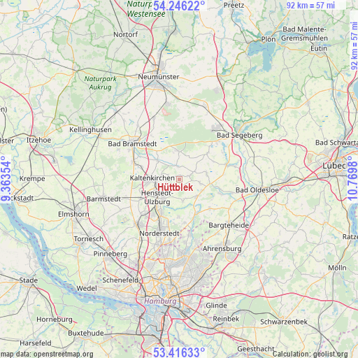
Hüttblek GPS coordinates[2]
53° 49' 59.988" North, 10° 4' 0.012" East
| Map corner | latitude | longitude |
|---|---|---|
| Upper-left | 54.24622°, | 9.36354° |
| Center: | 53.83333°, | 10.06667° |
| Lower-right: | 53.41633°, | 10.7698° |
| Map W x H: | 92.3×92.3 km | = 57.4×57.4mi |
| max Lat: | 55.01917° ⇑9.6% North |
| Hüttblek: | 53.83333° |
| min Lat: | ⇓90.4% South 47.40724° |
| min Long | Hüttblek | max Long |
| 5.92978° | 10.06667° | 14.98853° |
| W 51.1%⇐ | ⇒48.9% E |
Elevation
Elevation of Hüttblek is 52 m = 171 ft, and this is 197.1 m = 647 ft below average elevation for this country.
| Max E: |
1256 m = 4121 ft | 78.3% |
| Avg. | 249.1 m = 817 ft | |
| Hüttblek | 52 m = 171 ft | |
Min E: |
-5 m = -16 ft | 21.7% |
See also: Germany elevation on elevation.city.
Geographical zone
Hüttblek is located in North temperate zone (between Tropic of Cancer and the Arctic Circle). Distance of this North polar circle is 1415.5 km =879.6 mi to North.| Distance of | km | miles | from Hüttblek |
|---|---|---|---|
| North Pole | 4021.4 | 2498.8 | to North |
| Arctic Circle | 1415.5 | 879.6 | to North |
| Tropic Cancer | 3379.8 | 2100.1 | to South |
| Equator | 5985.7 | 3719.3 | to South |


Nearby cities:
15 places around Hüttblek: (largest is in red/bold)
• Hartenholm
7.3 km =4.5 mi,  356°
356°
• Henstedt-Ulzburg
6.8 km =4.2 mi,  242°
242°
• Itzstedt
6.6 km =4.1 mi,  115°
115°
• Kaltenkirchen
7.1 km =4.4 mi,  269°
269°
• Kampen
8.9 km =5.5 mi,  285°
285°
• Kattendorf
3.1 km =1.9 mi, 290°
• Kisdorf
3.8 km =2.4 mi, 240°
• Nahe
5.7 km =3.5 mi,  130°
130°
• Oersdorf
5 km =3.1 mi,  277°
277°
• Schmalfeld
8.6 km =5.3 mi,  310°
310°
• Seth
7.2 km =4.5 mi,  77°
77°
• Sievershütten
3.1 km =1.9 mi,  71°
71°
• Struvenhütten
3.9 km =2.4 mi,  343°
343°
• Stuvenborn
4.7 km =2.9 mi, 67°
• Winsen
3.3 km =2.1 mi, 270°
Sources, notices
• [Note1] Compared only with cities in Germany existing in our database
• [Src1] Map data: © OpenStreetMap contributors (CC-BY-SA)
• [Src2] Other city data from geonames.org with taken over terms of usage.
• [Src3] Geographical zone / Annual Mean Temperature by Robert A. Rohde @ Wikipedia
