Henstedt-Ulzburg geodata
Henstedt-Ulzburg (Schleswig-Holstein) is a seat of a fourth-order administrative division; located in Germany in Europe/Berlin (GMT+2) time zone. With population of 26,083 people, there are 559 cities with bigger population in this country. Compared to other cities in Germany, 90.1% of cities are located further ↓South; 50.4% of cities are located further →East and 82% of cities have higher elevation than Henstedt-Ulzburg. Note1
Administrative division(s):
- Level 1: Schleswig-Holstein
- Level 3: Kreis Segeberg
- Level 4: Henstedt-Ulzburg


Henstedt-Ulzburg GPS coordinates[2]
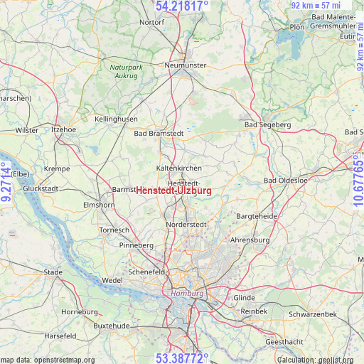
53° 48' 18" North, 9° 58' 28.272" East
| Map corner | latitude | longitude |
|---|---|---|
| Upper-left | 54.21817°, | 9.2714° |
| Center: | 53.805°, | 9.97452° |
| Lower-right: | 53.38772°, | 10.67765° |
| Map W x H: | 92.3×92.3 km | = 57.4×57.4mi |
| max Lat: | 55.01917° ⇑9.9% North |
| Henstedt-Ulzburg: | 53.805° |
| min Lat: | ⇓90.1% South 47.40724° |
| min Long | Henstedt-Ulzbur | max Long |
| 5.92978° | 9.97452° | 14.98853° |
| W 49.6%⇐ | ⇒50.4% E |
Elevation
Elevation of Henstedt-Ulzburg is 42 m = 138 ft, and this is 207.1 m = 679 ft below average elevation for this country.
| Max E: |
1256 m = 4121 ft | 82% |
| Avg. | 249.1 m = 817 ft | |
| Henstedt-Ulzburg | 42 m = 138 ft | |
Min E: |
-5 m = -16 ft | 18% |
See also: Germany elevation on elevation.city.
Geographical zone
Henstedt-Ulzburg is located in North temperate zone (between Tropic of Cancer and the Arctic Circle). Distance of this North polar circle is 1418.6 km =881.5 mi to North.| Distance of | km | miles | from Henstedt-Ulzburg |
|---|---|---|---|
| North Pole | 4024.5 | 2500.7 | to North |
| Arctic Circle | 1418.6 | 881.5 | to North |
| Tropic Cancer | 3376.6 | 2098.1 | to South |
| Equator | 5982.6 | 3717.4 | to South |


Nearby cities:
15 places around Henstedt-Ulzburg: (largest is in red/bold)
• Alveslohe
4.5 km =2.8 mi,  237°
237°
• Bilsen
7.4 km =4.6 mi,  234°
234°
• Ellerau
7.2 km =4.5 mi,  211°
211°
• Heidmoor
8.8 km =5.5 mi,  291°
291°
• Hüttblek
6.8 km =4.2 mi,  62°
62°
• Kaltenkirchen
3.3 km =2.1 mi,  340°
340°
• Kampen
6.2 km =3.9 mi, 335°
• Kattendorf
5.3 km =3.3 mi,  36°
36°
• Kisdorf
3.1 km =1.9 mi, 64°
• Langeln
7.5 km =4.7 mi,  259°
259°
• Nützen
7.8 km =4.8 mi,  331°
331°
• Oersdorf
3.9 km =2.4 mi,  16°
16°
• Schmalfeld
8.7 km =5.4 mi,  356°
356°
• Struvenhütten
8.5 km =5.3 mi, 35°
• Winsen
4.2 km =2.6 mi, 41°
Sources, notices
• [Note1] Compared only with cities in Germany existing in our database
• [Src1] Map data: © OpenStreetMap contributors (CC-BY-SA)
• [Src2] Other city data from geonames.org with taken over terms of usage.
• [Src3] Geographical zone / Annual Mean Temperature by Robert A. Rohde @ Wikipedia
