Jützenbach geodata
Jützenbach (Thuringia) is a populated place; located in Germany in Europe/Berlin (GMT+2) time zone. With population of 556 people, there are 9050 cities with bigger population in this country. Compared to other cities in Germany, 66.6% of cities are located further ↓South; 56.9% of cities are located further ←West and 53.1% of cities have lower elevation than Jützenbach. Note1


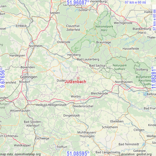
Jützenbach GPS coordinates[2]
51° 31' 31.836" North, 10° 22' 46.848" East
| Map corner | latitude | longitude |
|---|---|---|
| Upper-left | 51.96087°, | 9.67656° |
| Center: | 51.52551°, | 10.37968° |
| Lower-right: | 51.08595°, | 11.08281° |
| Map W x H: | 97.3×97.3 km | = 60.5×60.5mi |
| max Lat: | 55.01917° ⇑33.4% North |
| Jützenbach: | 51.52551° |
| min Lat: | ⇓66.6% South 47.40724° |
| min Long | Jützenbach | max Long |
| 5.92978° | 10.37968° | 14.98853° |
| W 56.9%⇐ | ⇒43.1% E |
Elevation
Elevation of Jützenbach is 247 m = 810 ft, and this is 2.1 m = 7 ft below average elevation for this country.
| Max E: |
1256 m = 4121 ft | 46.9% |
| Avg. | 249.1 m = 817 ft | |
| Jützenbach | 247 m = 810 ft | |
Min E: |
-5 m = -16 ft | 53.1% |
See also: Germany elevation on elevation.city.
Geographical zone
Jützenbach is located in North temperate zone (between Tropic of Cancer and the Arctic Circle). Distance of this North polar circle is 1672.1 km =1039 mi to North.| Distance of | km | miles | from Jützenbach |
|---|---|---|---|
| North Pole | 4278 | 2658.2 | to North |
| Arctic Circle | 1672.1 | 1039 | to North |
| Tropic Cancer | 3123.2 | 1940.7 | to South |
| Equator | 5729.1 | 3559.9 | to South |


Nearby cities:
15 places around Jützenbach: (largest is in red/bold)
• Bischofferode
5.5 km =3.4 mi,  125°
125°
• Brehme
3.8 km =2.4 mi,  202°
202°
• Duderstadt
8.4 km =5.2 mi,  260°
260°
• Ecklingerode
5.2 km =3.2 mi,  236°
236°
• Ferna
10 km =6.2 mi,  213°
213°
• Großbodungen
8.9 km =5.5 mi, 128°
• Haynrode
10 km =6.2 mi,  152°
152°
• Holungen
3.9 km =2.4 mi,  165°
165°
• Neustadt
8.9 km =5.5 mi,  136°
136°
• Rhumspringe
8.5 km =5.3 mi,  319°
319°
• Steinrode
8.2 km =5.1 mi,  108°
108°
• Tastungen
7.9 km =4.9 mi,  217°
217°
• Wehnde
6.4 km =4 mi, 222°
• Weißenborn-Lüderode
2.8 km =1.7 mi,  75°
75°
• Wintzingerode
9.7 km =6 mi, 198°
Sources, notices
• [Note1] Compared only with cities in Germany existing in our database
• [Src1] Map data: © OpenStreetMap contributors (CC-BY-SA)
• [Src2] Other city data from geonames.org with taken over terms of usage.
• [Src3] Geographical zone / Annual Mean Temperature by Robert A. Rohde @ Wikipedia
