Pfaffenhofen an der Ilm geodata
Pfaffenhofen an der Ilm (Bavaria) is a seat of a fourth-order administrative division; located in Germany in Europe/Berlin (GMT+2) time zone. With population of 23,192 people, there are 641 cities with bigger population in this country. Compared to other cities in Germany, 88.8% of cities are located further ↑North; 74.4% of cities are located further ←West and 79.7% of cities have lower elevation than Pfaffenhofen an der Ilm. Note1
Administrative division(s):
- Level 1: Bavaria
- Level 2: Upper Bavaria
- Level 3: Landkreis Pfaffenhofen an der Ilm
- Level 4: Pfaffenhofen an der Ilm
Current local time in Pfaffenhofen an der Ilm:
02:41 PM, TuesdayDifference from your time zone: hours


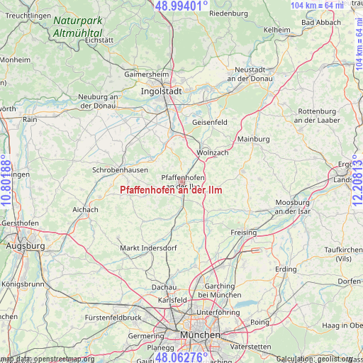
Pfaffenhofen an der Ilm GPS coordinates[2]
48° 31' 49.908" North, 11° 30' 18" East
| Map corner | latitude | longitude |
|---|---|---|
| Upper-left | 48.99401°, | 10.80188° |
| Center: | 48.53053°, | 11.505° |
| Lower-right: | 48.06276°, | 12.20813° |
| Map W x H: | 103.5×103.5 km | = 64.3×64.3mi |
| max Lat: | 55.01917° ⇑88.8% North |
| Pfaffenhofen an der Ilm: | 48.53053° |
| min Lat: | ⇓11.2% South 47.40724° |
| min Long | Pfaffenhofen an | max Long |
| 5.92978° | 11.505° | 14.98853° |
| W 74.4%⇐ | ⇒25.6% E |
Elevation
Elevation of Pfaffenhofen an der Ilm is 431 m = 1414 ft, and this is 181.9 m = 597 ft above average elevation for this country.
| Max E: |
1256 m = 4121 ft | 20.3% |
| Pfaffenhofen an der Ilm | 431 m 1414 ft | |
| Avg. | 249.1 m = 817 ft | |
Min E: |
-5 m = -16 ft | 79.7% |
See also: Germany elevation on elevation.city.
Geographical zone
Pfaffenhofen an der Ilm is located in North temperate zone (between Tropic of Cancer and the Arctic Circle). Distance of this North polar circle is 2005.1 km =1245.9 mi to North.| Distance of | km | miles | from Pfaffenhofen an der Ilm |
|---|---|---|---|
| North Pole | 4611 | 2865.1 | to North |
| Arctic Circle | 2005.1 | 1245.9 | to North |
| Tropic Cancer | 2790.2 | 1733.7 | to South |
| Equator | 5396.1 | 3353 | to South |


Nearby cities:
15 places around Pfaffenhofen an der Ilm: (largest is in red/bold)
• Allershausen
12.9 km =8 mi,  147°
147°
• Gerolsbach
11.4 km =7.1 mi,  248°
248°
• Hettenshausen
3.4 km =2.1 mi,  186°
186°
• Hohenkammer
11.9 km =7.4 mi,  172°
172°
• Ilmmünster
5.3 km =3.3 mi,  184°
184°
• Jetzendorf
12.6 km =7.8 mi,  211°
211°
• Kirchdorf
13.6 km =8.5 mi,  125°
125°
• Paunzhausen
7.6 km =4.7 mi,  144°
144°
• Pörnbach
10 km =6.2 mi,  343°
343°
• Reichertshausen
7.2 km =4.5 mi, 173°
• Rohrbach
10.6 km =6.6 mi,  25°
25°
• Scheyern
4.4 km =2.7 mi,  219°
219°
• Schweitenkirchen
7.9 km =4.9 mi,  112°
112°
• Waidhofen
13.5 km =8.4 mi,  292°
292°
• Wolnzach
12.1 km =7.5 mi,  47°
47°
Sources, notices
• [Note1] Compared only with cities in Germany existing in our database
• [Src1] Map data: © OpenStreetMap contributors (CC-BY-SA)
• [Src2] Other city data from geonames.org with taken over terms of usage.
• [Src3] Geographical zone / Annual Mean Temperature by Robert A. Rohde @ Wikipedia
