Hörstel geodata
Hörstel (North Rhine-Westphalia) is a populated place; located in Germany in Europe/Berlin (GMT+2) time zone. With population of 19,894 people, there are 782 cities with bigger population in this country. Compared to other cities in Germany, 75.1% of cities are located further ↓South; 85.2% of cities are located further →East and 80.2% of cities have higher elevation than Hörstel. Note1
Administrative division(s):
- Level 1: North Rhine-Westphalia
- Level 2: Regierungsbezirk Münster
- Level 3: Kreis Steinfurt
- Level 4: Hörstel


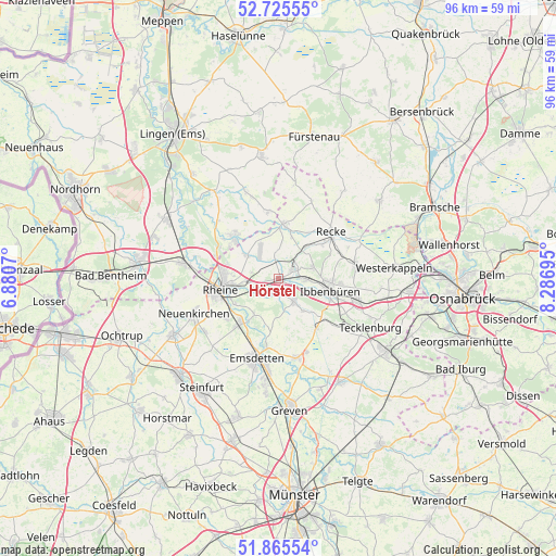
Hörstel GPS coordinates[2]
52° 17' 51.468" North, 7° 35' 1.752" East
| Map corner | latitude | longitude |
|---|---|---|
| Upper-left | 52.72555°, | 6.8807° |
| Center: | 52.29763°, | 7.58382° |
| Lower-right: | 51.86554°, | 8.28695° |
| Map W x H: | 95.6×95.6 km | = 59.4×59.4mi |
| max Lat: | 55.01917° ⇑24.9% North |
| Hörstel: | 52.29763° |
| min Lat: | ⇓75.1% South 47.40724° |
| min Long | Hörstel | max Long |
| 5.92978° | 7.58382° | 14.98853° |
| W 14.8%⇐ | ⇒85.2% E |
Elevation
Elevation of Hörstel is 46 m = 151 ft, and this is 203.1 m = 666 ft below average elevation for this country.
| Max E: |
1256 m = 4121 ft | 80.2% |
| Avg. | 249.1 m = 817 ft | |
| Hörstel | 46 m = 151 ft | |
Min E: |
-5 m = -16 ft | 19.8% |
See also: Germany elevation on elevation.city.
Geographical zone
Hörstel is located in North temperate zone (between Tropic of Cancer and the Arctic Circle). Distance of this North polar circle is 1586.2 km =985.6 mi to North.| Distance of | km | miles | from Hörstel |
|---|---|---|---|
| North Pole | 4192.1 | 2604.8 | to North |
| Arctic Circle | 1586.2 | 985.6 | to North |
| Tropic Cancer | 3209 | 1994 | to South |
| Equator | 5815 | 3613.3 | to South |


Nearby cities:
15 places around Hörstel: (largest is in red/bold)
• Beesten
16.1 km =10 mi,  339°
339°
• Birgte
7.1 km =4.4 mi,  141°
141°
• Dreierwalde
6.7 km =4.2 mi,  304°
304°
• Emsdetten
14.3 km =8.9 mi,  195°
195°
• Hopsten
9.4 km =5.8 mi,  7°
7°
• Ibbenbüren
9.1 km =5.7 mi,  102°
102°
• Mettingen
13.7 km =8.5 mi,  81°
81°
• Neuenkirchen
15.6 km =9.7 mi,  247°
247°
• Recke
12.2 km =7.6 mi,  49°
49°
• Rheine
9.8 km =6.1 mi,  261°
261°
• Saerbeck
14.2 km =8.8 mi,  166°
166°
• Salzbergen
16.4 km =10.2 mi,  284°
284°
• Schapen
11.4 km =7.1 mi,  354°
354°
• Spelle
11.1 km =6.9 mi,  313°
313°
• Tecklenburg
17.9 km =11.1 mi,  119°
119°
Sources, notices
• [Note1] Compared only with cities in Germany existing in our database
• [Src1] Map data: © OpenStreetMap contributors (CC-BY-SA)
• [Src2] Other city data from geonames.org with taken over terms of usage.
• [Src3] Geographical zone / Annual Mean Temperature by Robert A. Rohde @ Wikipedia
